Sie haben Ihr Suchlimit erreicht
Starten Sie Ihren kostenlosen Testzugang, um weiterhin alle Traffic- und Performance-Insights zu erkunden.
Los geht'sMobile Topographer GIS App-Analysen für 4. März
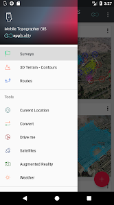
Mobile Topographer GIS
- applicality
- Google Play Store
- Kostenlos
- Produktivität
The beloved choice of the professionals, Mobile Topographer ...meets... GIS.
You can now perform a complete survey without any limitations into complexity or volume of data.
Try now Mobile Topographer GIS by using the three days free trial period. Just download the app and proceed with he subscription procedure. Although, you will be asked to provide billing information, you will NOT be charged before the end of the three days of the free trial period. You can cancel your subscription at any time during the three days trial period, free of charge. Charges will only occur, if at the end of the three days you still have an active subscription.
- Collect GNSS readings using increased accuracy (GPS, GLONASS, Galileo, Beidou, QZSS constellations supported).
- Connect your external GNSS receiver via mock locations and use Mobile Topogrpaher GIS as a processing unit.
- Display data into WGS84 or you local projected CRS.
- Convert from WGS84 to local projected CRS and vice versa.
- Real time projection on map.
- *** NEW *** Custom image or WMS server as map background.
- Find a marked point in the real world by using "Drive me"
- Calculate Orthometric height on the fly using EGM model or local elevation grids where available.
- Organize your work into Points - Shapes - Entities & Surveys. You can now create individual points, multi-point groups, multipart polylines, and multipart polygons with holes.
- Create a full drawing with as much details as you want.
- *** NEW *** geodetic tools. Add indirect points via on of the following options: 1 point + Distance + Azimuth, 2 points + Distances + Select, 2 points + Azimuths, 3 points + Distances, Midpoint of line, Divide line, Extend line, Parallel line, Perpendicular to line.
- Nest your jobs, in any nesting level, to create a super-survey.
- Share data between jobs with active links.
- Exchange jobs between your mobile device and your desktop computer, with import - export functions using all common formats .txt, .csv, .kml, .gpx, .dxf and Shape files (.shp - .shx - .dbf)
- Collaborate with your partners by exchanging and sharing from one point to complete jobs.
- Create the 3D terrain of an area by simply walking through it.
- Calculate contours and add them into your survey with lightning speeds.
- View a real 3D model directly into your device.
- Store a route with its data.
- Show GNSS satellites with signal info in both compass view or AR.
- Backup and restore your data using an SQL .db file.
Welcome to the era of mobile surveying...!
Find more about Mobile Topographer GIS in:
http://applicality.com/projects/mobile-topographer-gis/
Download the user's manual from:
http://applicality.com/app_documentation/web/MobileTopographerGIS_Manual.pdf
Mobile Topographer GIS-Nutzungsrang
Das Ranking der Nutzung basiert auf dem Algorithmus von Similarweb, der aktuelle Installationen und aktive Benutzer:innen über einen Zeitraum von 28 Tagen berechnet.
Alle Kategorien in
Vereinigte Staaten--
Produktivität in
Vereinigte Staaten--
Top-Wettbewerber und alternative Apps
Apps mit hoher Wahrscheinlichkeit, von denselben Benutzer:innen aus demselben Store verwendet zu werden.
Mergin Maps: QGIS in pocket
Avenza Maps: Offline Mapping
Orca: Boat GPS, Charts, Routes
Gaia GPS: Offline Trail Maps
März 4, 2026