You’ve hit your search limit
Start your free trial to keep exploring full traffic and performance insights.
Get Startedtopoguide Greece app analytics for February 21
topoguide Greece
- Topoguide
- Google Play Store
- Free
- Maps & Navigation
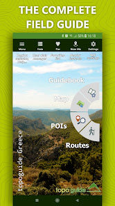
Topoguide gives access to all topoguide.gr hiking destinations with even more content than the website!
The free version gives access to a demo destination: Lycabettus in Attica region.
The other destinations are sold as in-app products, each with:
• Thousands of hiking and cyclings routes with descriptions and photos
• Offline topographic maps of the area
• Guidebook with an extensive introduction on the geography, the nature and the paths of the area
• Offline search for hundreds of POIs
In the field, the app identifies the nearest route, guides you to it and then along it by displaying messages and warnings on every junction or other important location. On each Point of Interest, photos and texts are displayed on the map. If the hiker gets off-trail, the app indicates the shorter way to get back safely.
Topoguide's team of cartographers has previously published hundreds of detailed hiking maps for Greece. To ensure data accuracy, all routes provided in our app are walked or driven by our team.
The available destinations are:
• Long Trails: Menalon Trail, Corfu Trail, National Trail Ο22, Ursa Trail, Long Pelion Trail, Nestos-Rodopi Trail
• Attica: Athens birding, Geraneia, Hymettus, Kitheronas, Lycabettus, Parnitha, Pendeli
• Central Greece (including Thessaly): Dirfys, Elikonas, Giona, Nafpaktia Uplands, Oeta, Parnassos, Kirfis, Vardousia, Pelion (Central, Eastern, Southern & Western)
• Peloponnese: Chelmos, Elafonisos, Epidavros, Methana, Poros & Trizinia, Mani (Areopoli, Avia, Kardamili, Tenaro), Menalon Trail, Parnonas, Taygetos, Ziria
• Northern Greece (Epirus, Macedonia & Thrace): Valia Calda, Ursa Trail, Zagori
• Crete: Chania, Elafonisi, Gramvousa, Lefka Ori - Samaria
• Aegean islands (Cyclades, Saronic, Sporades & Dodecanese): Amorgos, Kea, Kythnos, Naxos, Santorini, Serifos, Sifnos, Tinos, Skyros, Kalymnos, Aegina, Hydra
• Ionian islands: Corfu Trail, Kefalonia, Zakynthos
topoguide Greece Usage Rank
The usage rank is based on Similarweb's algorithm that calculates current installs and active users over a 28-day period.
All Categories in
United States--
Maps & Navigation in
United States--
Top Competitors & Alternative Apps
Apps with a high probability of being used by the same users, from the same store.
Harvest Hosts - RV Camping
Oahu Hawaii Audio Tour Guide
Trailforks
BBBUS COM
February 21, 2026