You’ve hit your search limit
Start your free trial to keep exploring full traffic and performance insights.
Get StartedAFIS Wildfire Map analisi dell'app per 18 aprile
AFIS Wildfire Map
- Council for Scientific and Industrial Research
- App Store di Apple
- Gratis
- Meteo
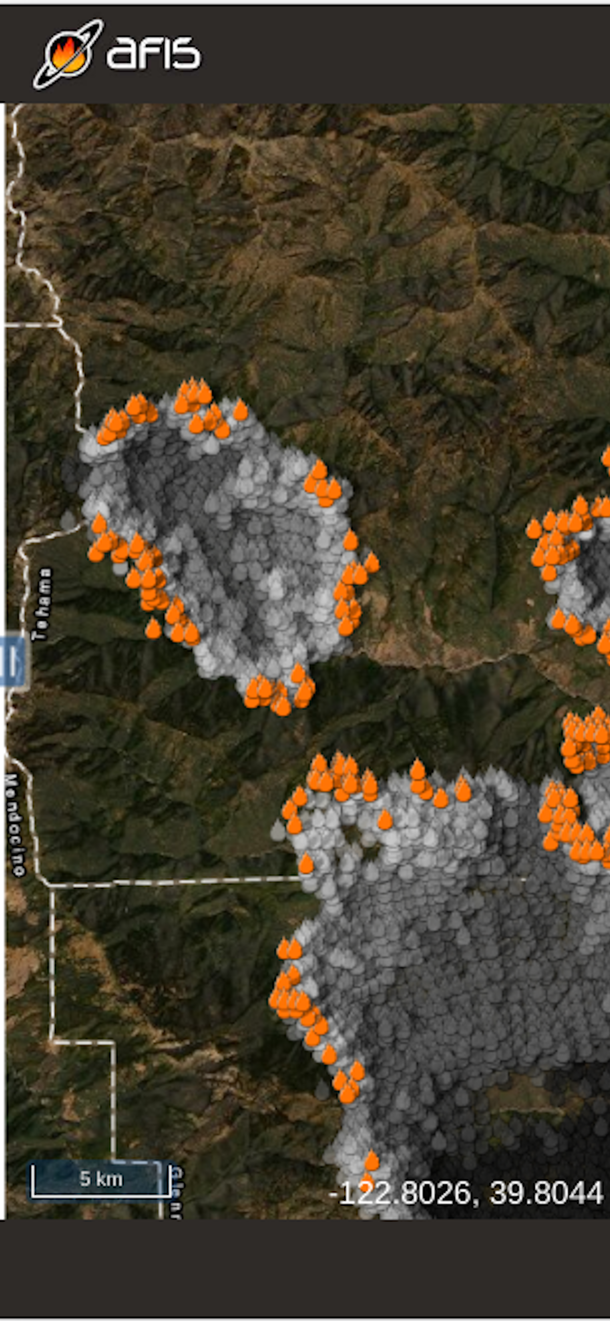
Get the latest updates on wildfire locations with the CSIR's AFIS Wildfire Map app that puts vital wildfire information at your fingertips. AFIS gives you access to fires detected globally by NASA's Terra and Aqua satellites as well as the SNPP and NOAA-20 satellites.
This app provides native access to the AFIS Viewer that is available online at https://viewer.afis.co.za/
This app replaces the previous AFIS app that was no longer maintainable. New features will be added over time.
Visit the South African Council for Scientific and Industrial Research (CSIR) website for more information about the organization behind AFIS: https://www.csir.co.za
Classifica degli store
La classifica del store si basa su diversi parametri stabiliti da Google e Apple.
Tutte le categorie in
Stati Uniti--
Meteo in
Stati Uniti--
Principali concorrenti e app alternative
App con un'alta probabilità di essere utilizzate dagli stessi utenti, provenienti dallo stesso store.
Active Wildfire Tracker Map
Firespot: Wildfire app
The Wildfire Tracker
SmokeWx
aprile 18, 2026