You’ve hit your search limit
Start your free trial to keep exploring full traffic and performance insights.
Get StartedAustralia Topo Maps analisi dell'app per 16 febbraio
Australia Topo Maps
- ATLOGIS Geoinformatics GmbH & Co. KG
- Google Play Store
- Gratis
- Mappe e navigazione
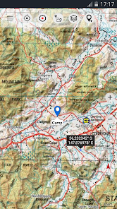
Easy to use Outdoor/Offline GPS navigation app with access to the best topographic maps and satellite images for Australia.
++ For offline use PRO features needed ! ++
Turn your Andoid Phone/Tablet into an outdoor GPS for trips into the backcountry WITHOUT CELL COVERAGE. This app gives you similar mapping options as you might know from Garmin or Magellan GPS handhelds.
Included FREE map layers:
• NATMAP 1:250.000 Topo Maps, latest edition, enriched with hillshading and additional placenames !
• Getlost Maps: topographic and touring maps for complete Australia in 1:75.000 and 1:250.000, Victoria & East NSW in 1:25.000
• Australia Base Map: Seamless national dataset for whole of Australia. Very detailed !
• Queensland Topo Maps: HiRes topographic maps
• New South Wales Maps: HiRes topographic maps (scanned raster & digital) + HiRes Imagery
• South Australia: HiRes topographic maps & Street Maps
• Tasmania Maps: HiRes topographic maps + HiRes Imagery
• Northern Territory Atlas
• OpenStreetMaps : These crowdsourced maps are a very useful addition to other map layers. Contains many unique features.
• OpenCycleMaps: These maps are ideal to plan bicycle trips
• Geological Map (for biologists, geologists, miners, ...)
• ESRI Topographic
• ESRI Aerial Images
• ESRI Street Map
• Google Road Map (online access only)
• Google Satellite Images (online access only)
• Google Terrain Map (online access only)
• Bing Road Map (online access only)
• Bing Satellite Images (online access only)
• Earth At Night
• Hillshading and contourlines (20m) overlay (worldwide)
• Transport/Infrastructure overlay
Premium Map layers:
• Victoria 1:25.000
For only 78,99 $ (AUD) you get unlimited access to all 25k Vic topo map sheets (865 maps !) - stitched together to a seamless mosaik (complete coverage) ! Easy to download and offline use ! Single GeoPDF map sheets cost 8,5$ at Vic DELWP office !
• Western Australia 1:25.000 - 1:100.000
For only 154,99 $ (AUD) you get unlimited access to all available 25k,50k and 100k WA topo map sheets (3044 maps!) - stitched together to a seamless mosaik ! Easy to download and offline use ! Single GeoPDF map sheets cost 12,6$ at WA Landgate office !
Main features for outdoor-navigation:
• Create and edit Waypoints
• GoTo-Waypoint-Navigation
• Track Recording (with speed, elevation and accuracy profile)
• Tripmaster with fields for odometer, average speed, bearing, elevation, etc.
• GPX/KML/KMZ Export
• Search (placenames, POIs, streets)
• Customizable datafields in Map View and Tripmaster (e.g. Speed, Distance, Compass, ...)
• Share Waypoints, Tracks or Routes (via eMail, Whatsapp, Dropbox, Facebook, ..)
• Display coordinates in Lat/Lon, UTM or MGRS/USNG (Military Grid/ US National Grid)
• Record & share tracks with statistics & elevation profile
• Rotate map (Track Up & North Up)
• Get Elevation by long click on map
• Track Replay
• and many more ...
Available Pro features: (Pro features available via In App Purchase)
• Offline Use - no cell coverage needed. No Roaming fees !
• Easy+Fast Bulk-download of map tiles for OFFLINE USAGE (not for Google and Bing maps)
• Create and edit Routes
• Route-Navigation (Point-to-Point Navigation)
• GPX/KML/KMZ Import
• unlimited Waypoints & Tracks
• Add other Map Tile-Server
• No Ads
Offline Use:
All viewed map tiles are kept in cache. To cache large areas you need to purchase Pro features.
Use this navigation app for outdoor activities like hiking, biking, camping, climbing, riding, skiing, canoeing, hunting, offroad 4WD tours or search&rescue (SAR).
Add custom waypoints in longitude/latitude, UTM or MGRS/USNG format with WGS84 datum.
Import/Export/Share GPS-Waypoints/Tracks/Routes in GPX or Google Earth KML/KMZ format.
Preload FREE map data for areas without cell service (Pro feature !).
Comments and feature requests to info@atlogis.com
+++ We DO NOT track any user activities or collect any user data ! +++
Ranking di utilizzo di Australia Topo Maps
Il ranking di utilizzo si basa sull'algoritmo di Similarweb che calcola le installazioni correnti e gli utenti attivi su un periodo di 28 giorni.
Tutte le categorie in
Stati Uniti--
Mappe e navigazione in
Stati Uniti--
Principali concorrenti e app alternative
App con un'alta probabilità di essere utilizzate dagli stessi utenti, provenienti dallo stesso store.
Shaka Guide | GPS Audio Tours
TrailLink: Bike, Run, Walk
Trails Offroad: Offline Maps
FarOut
febbraio 16, 2026