Altimeter: Elevation, Compass のアプリ分析 2月22日
Altimeter: Elevation, Compass
- Furkan Ozoglu
- Apple App ストア
- 無料
- ナビゲーション
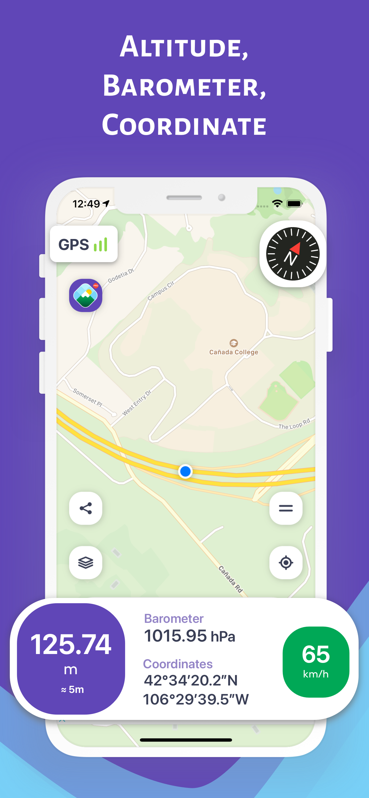
While traveling with a vehicle (car, bicycle, etc.), while hiking or climbing, you can instantly discover your location and altitude, direction, geographic coordinate, address and atmospheric pressure on the map. While following your direction on a detailed compass screen, you can also monitor the change in altitude. You can share the photos you take with your loved ones, including your altitude, geographic coordinates and address information. Depending on the shooting angle, the compass direction is also included in the photos.
DISCOVER YOUR HEIGHT FROM SEA ON THE MAP (Normal Mode)
You can instantly discover the information of your location on the map
- Altitude (elevation) above sea level
- Open air (atmosphere) pressure
- Latitude and longitude coordinates and address
- Speed in motion
- Direction with a detailed compass
FOLLOW YOUR HEIGHT FROM SEA ON THE MAP ON THE MOVE (Track Mode on the Map)
On the map when traveling in a vehicle (car, bike, etc.), hiking or climbing, you can instantly track your location and the change in information
- Altitude (elevation) above sea level
- Open air (atmosphere) pressure
- Latitude and longitude coordinates and address
- Speed in motion
- Direction with a detailed compass
FOLLOW YOUR HEIGHT FROM SEA ON THE COMPASS (Compass Mode)
While traveling with a vehicle (car, bicycle, etc.), while taking a walk or climbing, you can instantly track your direction and the altitude of your current location
SHARE YOUR PHOTO WITH YOUR LOVED ONES WITH HEIGHT AND DIRECTION INFORMATION (Sharing Mode)
While traveling with a vehicle (car, bike, etc.), hiking or climbing, you can share the photos you have taken with this information
- Height, pressure, coordinate and address information will be on the photo
- Depending on the shooting angle, the compass direction will be added to the photo
YOU CAN ACCESS ALTITUDE AND LOCATION INFORMATION FROM APPLE WATCH
IMPORTANT REMINDER ABOUT CALCULATION METHOD AND ACCURACY
- The coordinates of the altitude and location are calculated using the GPS signals of the device used
- There may be differences in the measurement values depending on the GPS signal quality of the device's location
- Just below the height value, the accuracy value of the measurement is given instantly in meters
- Compass accuracy may be affected by magnetic or environmental interference
ストアランキング
ストアランキングは、GoogleとAppleが設定した複数のパラメータに基づいています。
業界別 ウェブサイトカテゴリーで
米国--
ナビゲーションで
米国--
2月 22, 2026