You’ve hit your search limit
Start your free trial to keep exploring full traffic and performance insights.
Get StartedAnálisis de la app EasyCockpit para 24 de abril
EasyCockpit
- Aviation.Direct (Pty) Ltd
- App Store de Apple
- Gratis
- Navegación
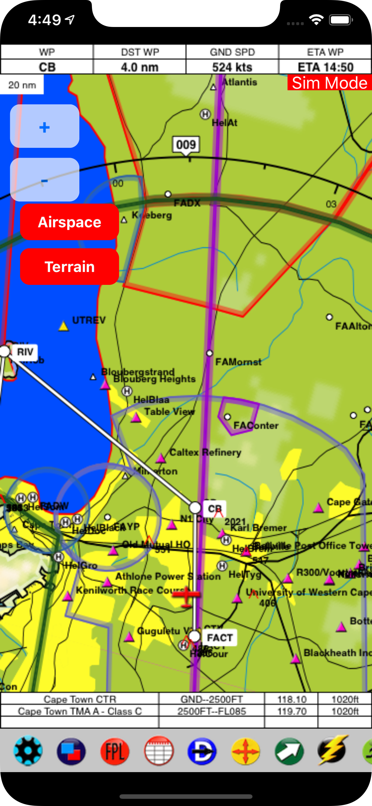
EasyCockpit is a comprehensive aviation navigation tool for mobile devices and has for many years aided pilots by improving their situational awareness when flying in Southern Africa. This GPS moving map software with detailed information will make your flying experience in this part of the African continent a safer one. The high-resolution clear vector map is offering an extensive airfields database including communication and navigation frequencies, runway information, fuel availability, cautionary notes, and sunrise/sunset times. Full airspace information, including special VFR routings and reporting points around congested areas, makes this GPS moving map a must for pilots flying in Southern Africa. Visit our website for details on how to obtain the full version.
Comprehensive Mapping data
Coverage: South Africa, Botswana, Lesotho, Malawi, Namibia, Swaziland, Angola, Mozambique, Zambia, Zimbabwe
Flight Planning by selecting waypoints/ abeam waypoints from database or map. Option to insert Airspace Intersection. Option to upload routes from EasyPlan.
Layers can be switched on or off.
Terrain display
FlightLog displays distance to next waypoint, ground speed, desired track, ETE and ETA. Also displays current position in relation to recognized VFR points for accurate reporting.
Direct-To function shows the 10 nearest airfields and 10 nearest navaids or other points.
Move-To button lets you quickly find a point from the database to check details and view it on the map.
HSI needle determines the distance off Track.
The RMI needles allow you to choose one or two points to which the needles will point to provide a bearing.
The OBI radial or Track-To can be selected to be displayed from any waypoint, navaid or airfield.
E6B calculator allows for accurate and speedy calculation of density altitude, true airspeed, windspeed and direction.
Airspace, obstacle and Terrain warnings.
Fly in Track-Up or North-Up mode.
Continued use of GPS running in the background can dramatically decrease battery life.
Clasificación de tiendas
El Store Rank se basa en múltiples parámetros establecidos por Google y Apple.
Todas las categorías en
Estados Unidos--
Navegación en
Estados Unidos--
Principales competidores & aplicaciones alternativas
Aplicaciones con una alta probabilidad de ser utilizadas por los mismos usuarios, desde la misma tienda.
Flight Navigation for Pilots
Horizon Portable Glass Cockpit
AviNavi, navigation for pilots
Enroute Flight Navigation
abril 24, 2026