You’ve hit your search limit
Start your free trial to keep exploring full traffic and performance insights.
Get StartedAnálisis de la app Live Satellite View & GPS Maps para 26 de abril
Live Satellite View & GPS Maps
- Muhammad Asad Khan
- App Store de Apple
- Gratis
- Navegación
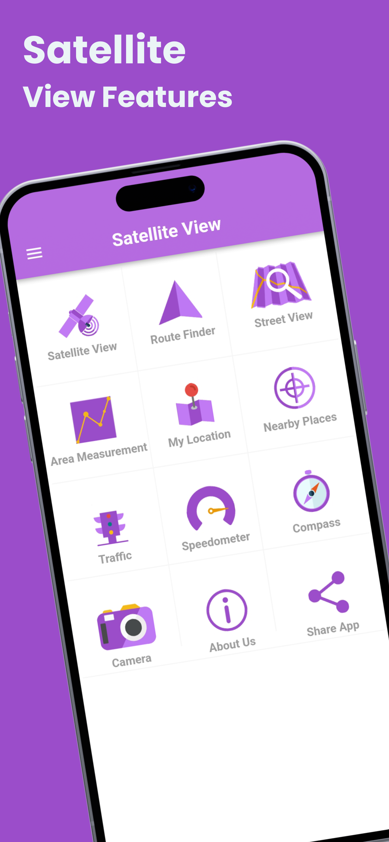
Satellite View is your ultimate tool for exploring the world from a whole new perspective! With high-resolution satellite imagery and real-time GPS tracking, this app lets you view any location on Earth from space. Whether you're planning a trip, exploring remote regions, or simply curious about the world around you, Satellite View offers seamless access to a wealth of geographical data, all at your fingertips.
Key Features:
* Real-Time Satellite Imagery: Access up-to-date satellite images of any location worldwide, allowing you to explore Earth with vivid, high-resolution details.
* Interactive Maps & Navigation: Seamlessly switch between satellite, terrain, and hybrid map views to navigate and explore locations with ease.
* GPS Tracking: Pinpoint your exact location with live GPS tracking, making it easy to plan routes and discover places nearby.
* Global Coverage: View satellite images from every corner of the planet, including urban areas, landscapes, oceans, and even remote regions.
* Zoom In/Out: Enjoy smooth zooming features, enabling you to get a closer look at both small and large geographical features.
* Satellite Layers & Customization: Toggle various layers, such as terrain, roads, borders, and more, for a personalized map experience.
* Historical Imagery: Explore past satellite imagery to see how specific areas have changed over time.
* User-Friendly Interface: Designed with simplicity in mind, the app’s intuitive interface makes it easy for users of all ages to navigate and explore.
* Offline Mode: Download specific regions for offline use, allowing you to access satellite imagery even when you’re not connected to the internet.
* Travel Planning: Get a bird's-eye view of destinations to plan your trips and understand the geography of your surroundings.
* Education & Learning: Ideal for students and researchers, the app provides an interactive platform for learning about the Earth’s geography, climate, and ecosystems.
* Outdoor Adventures: Use the satellite imagery to explore hiking trails, camping spots, and remote natural areas with real-world accuracy.
* Real Estate & Property Search: Explore property locations, assess landscapes, and analyze the proximity of amenities and infrastructure.
*
With Satellite View, you can explore Earth’s beauty, discover hidden locations, and view the planet as you've never seen before. Stay up-to-date with the latest satellite imagery and make informed decisions with real-time GPS data. Whether you’re a traveler, student, or outdoor enthusiast, Satellite View is your go-to app for exploring the world.
Clasificación de tiendas
El Store Rank se basa en múltiples parámetros establecidos por Google y Apple.
Todas las categorías en
Estados Unidos--
Navegación en
Estados Unidos#164
Principales competidores & aplicaciones alternativas
Aplicaciones con una alta probabilidad de ser utilizadas por los mismos usuarios, desde la misma tienda.
Live Satellite View & Maps
GPS & Maps Navigator
TerraCam: GPS Satellite
Street View - Map Navigation
abril 26, 2026