You’ve hit your search limit
Start your free trial to keep exploring full traffic and performance insights.
Get StartedAnálisis de la app GNSS Status (GPS Test) para 22 de febrero
GNSS Status (GPS Test)
- Harnisch Gesellschaft m.b.H.
- Google Play Store
- Gratis
- Mapas y navegación
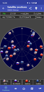
This app is a tool for displaying the GPS status and the status of other GNSS (global navigation satellite systems). It provides all information about all GNSS supported by your device (GPS, GLONASS, Galileo, BeiDou, ...).
Your location can be shown as latitude/longitude, UTM (Universal Transverse Mercator), MGRS (Military Grid Reference System), OLC (Open Location Code / Plus Code), Mercator, QTH/Maidenhead, Geohash or CH1903+.
Via the "Share" functionality you can share your location to tell someone exactly where you are, this can be very helpful not only in emergencies. Location can be shared as latitude/longitude or as link to all major map services.
Furthermore, functions such as a GPS speedometer, a "Find my car" and a "My Places" functionality are integrated. This makes it possible to calculate and display routes to the location of the car or to other previously saved locations and to be able to navigate there.
The app supports the display of any GPX files with various map services.
New: Record your tracks while hiking, running or cycling, or import GPX files to find the right path while hiking, running or cycling. Export your captured tracks as GPX files. While hiking, running or cycling, you can share your previous route and your current location as a GPX file via email or social networks at any time. The finished GPX file can also be shared via email and social networks. At the recipient of the shared GPX file, clicking on this file opens and displays our app.
Choose between several map providers for the map displays, we also support offline maps!
Clasificación del uso de GNSS Status (GPS Test)
El rango de uso se basa en el algoritmo de Similarweb que calcula las instalaciones actuales y los usuarios activos durante un periodo de 28 días.
Todas las categorías en
Alemania--
Mapas y navegación en
Alemania#250
Intereses de los usuarios & Top categorias
Principales categorías y aplicaciones utilizadas por los usuarios de GNSS Status (GPS Test).
Categorías principales
Afinidad
Principales aplicaciones de la categoría
18%
13%
13%
11%
Principales competidores & aplicaciones alternativas
Aplicaciones con una alta probabilidad de ser utilizadas por los mismos usuarios, desde la misma tienda.
GPS Essentials
Orca: Boat GPS, Charts, Routes
Guru Maps Pro & GPS Tracker
Holland America Line Navigator
febrero 22, 2026