You’ve hit your search limit
Start your free trial to keep exploring full traffic and performance insights.
Get StartedAnálisis de la app Boat Beacon - AIS Navigation para 27 de abril
Boat Beacon - AIS Navigation
- Electric Pocket
- Google Play Store
- Pagado
- Mapas y navegación
AIS receiver and display using just your Android device.
Boat Beacon is the only Marine AIS ship tracking app to provide Collision Detection, use real-time data and share your own boat’s position with other internet AIS users.
Specifically designed for use on the water, as well as showing all the Ships around you on a chart, Boat Beacon uniquely provides Bearing, Range and Closest Point of Approach (CPA) calculations in addition to AIS ship information. Transmits as well as receives internet AIS and is the only app that continuously monitors CPA, notifying if potential collisions are detected even when the app is in the background.
Key Features
------------
Receives and sends AIS ship data in real-time via the internet. No VHF AIS receiver, transponder or aerial required.
Over the horizon Collision and SART detection (30 miles radius) using continuous Closest Point of Approach (CPA) calculations - highlights boats that are on a potential collision course and alarms even when the app is in the background.
Provides Bearing and Distance information to other boats in addition to AIS information like speed, course, location, name, length etc. Shows you a track of the boats most recent voyage.
Share your live position, speed course and destination. People can follow you using Boat Beacon or our free Boat Watch app and on leading internet AIS systems like MarineTraffic and Ship Finder. Transmit also works continuously in the background when enabled.
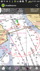
Live Map view with compass overlay which rotates with you so you can look in the direction of the ships on the map to locate them. You can also tilt the map to get a 3D perspective by dragging upwards with two fingers.
NOAA US and UKHO Marine Charts (IAP required)
Extensive details on other ships including Photos.
Search for boats or places by name or MMSI.
Share your track and position with friends and family instantly and in real time via email, Twitter and Facebook etc.
AIS Share lets you share BoatBeacon's live AIS data with other apps like Navionics on your device. (IAP required with free 3 day trial)
Man Overboard (MOB) & Anchor Watch:-
-MOB tracks the position, distance, bearing & time in water.
-Anchor Watch marks your anchor's position & alerts if you drift out of range or too fast (IAP with free 3 day trial).
Arm all the crews in a race with Boat Beacon and see real time updates on the race positions. Watch the action and replay it back in the Club-house with Boat Beacon's dedicated live race web pages.
VHF AIS with RTL-SDR and AIS Share app.
Local NMEA AIS via Wifi and USB.
Boat Beacon requires internet access to work. Most popular coastal areas around the world including the US and UK have mobile data access (2G or better) extending 12 or more miles out to sea.
Requirements:
Android Smartphone or Tablet with GPS.
Internet connection.
You do not need an MMSI to use Boat Beacon and you can be seen on Boat Beacon by other Boat Beacon users without having one. However if you want to be seen on Global AIS systems like Marine Traffic, Ship Finder and AIS Hub, etc. then you will need to have and use an MMSI number. If you don't have an MMSI for your boat you can obtain one in the US by visiting http://www.boatus.com/mmsi (the USCG approved agent). Alternatively email us for a free internet MMSI number.
Please note that continued use of GPS running in the background can dramatically decrease battery life.
AIS Ship data is provided by a network of voluntary AIS shore based stations. Some areas may not have AIS coverage.
N.B. This is not an AIS transponder. You will not be visible to other ships on their AIS systems unless they also use data from the same land based AIS networks.
NOT FOR NAVIGATION
This program is distributed in the hope that it will be useful. Boat Beacon should only be used for basic navigation reference and should not be solely relied upon to determine precise locations, proximity, distance, or direction.
Clasificación del uso de Boat Beacon - AIS Navigation
El rango de uso se basa en el algoritmo de Similarweb que calcula las instalaciones actuales y los usuarios activos durante un periodo de 28 días.
Todas las categorías en
Estados Unidos--
Mapas y navegación en
Estados Unidos--
Intereses de los usuarios & Top categorias
Principales categorías y aplicaciones utilizadas por los usuarios de Boat Beacon - AIS Navigation.
Categorías principales
Afinidad
Principales aplicaciones de la categoría
Más aplicaciones
63%
16%
9%
9%
Principales competidores & aplicaciones alternativas
Aplicaciones con una alta probabilidad de ser utilizadas por los mismos usuarios, desde la misma tienda.
Chargeway
EcoNet
VesselFinder
ABAX Admin
abril 27, 2026