You’ve hit your search limit
Start your free trial to keep exploring full traffic and performance insights.
Get StartedAnalyse de l'application Mappt: Mobile Mapping & GIS pour le 3 mai
Mappt: Mobile Mapping & GIS
- Soar.Earth Ltd
- Google Play Store
- Gratuit
- Productivité
*** PLEASE NOTE: You can use Mappt for the first 120 minutes of each session for free. However, after this time is up, you will need to purchase a monthly license from US$29 to unlock full functionality. For more information about features and licensing tiers, please visit www.mappt.com.au/pricing.***
- - - - - -
Mappt is a powerful mobile and GIS (Geographic Information System) data collection app that allows users to create, edit, store and share location-based data using your Android device.
Mappt is used in industries spanning from environmental and agriculture, to mining and local government in over 130 countries worldwide.
Mappt can export your mapping data into popular GIS formats compatible with common GIS applications including ArcGIS and QGIS.
In addition, the user friendly interface provides easy to use features that even those new to field data collection will master in minutes, including:
- Add geotagged photos to give your important data a far more visual element than just a marker point
- Create or edit drop down forms for faster data collection
- Allows Offline GPS tracking
- On-screen annotation tools to draw, add text and create shapes over your data
- Read and download a full suite of WMS/WFS & WMTS datasets
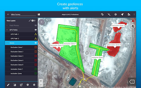
- Points, polygons and polylines and add attributes including geofencing capabilities
- Overlay coordinate grids see the exact distance between areas
- Street view mode with on-screen annotations available
- Import unlimited sized satellite, aerial, geological, topographic, elevation and other types of imagery in ECW and JP2 format
- Import and export popular GIS formats such as Shapefiles, JP2 and KML/KMZ (compatible with both WGS84 and GDA 2020)
- Share your data between popular cloud storage tools such as Google Drive
Users have chosen Mappt for a range of in-field tasks including:
- Field mapping
- Land surveying
- Vegetation management
- Forestry planning
- Environmental management
- Incident reporting
- Mine management
- Farm mapping
- Utility mapping
- Government planning
- Asset management
Leave internet worries, bulky equipment and inaccurate data in the past, and experience a more efficient future of data collection with Mappt.
Rang d'utilisation de Mappt: Mobile Mapping & GIS
Le classement d'utilisation est basé sur l'algorithme de Similarweb qui calcule les installations actuelles et les utilisateurs actifs sur une période de 28 jours.
Toutes les catégories dans
États-Unis--
Productivité dans
États-Unis--
Principaux concurrents & apps alternatives
Applications ayant une forte probabilité d'être utilisées par les mêmes utilisateurs, à partir du même store.
CalTopo
Spoked: AI Cycling Coach
Mergin Maps: QGIS in pocket
mai 3, 2026