

Trailseek のアプリ分析 8月31日

Trailseek
- MICHAEL CHERRY
- Apple App ストア
- 無料
- ナビゲーション
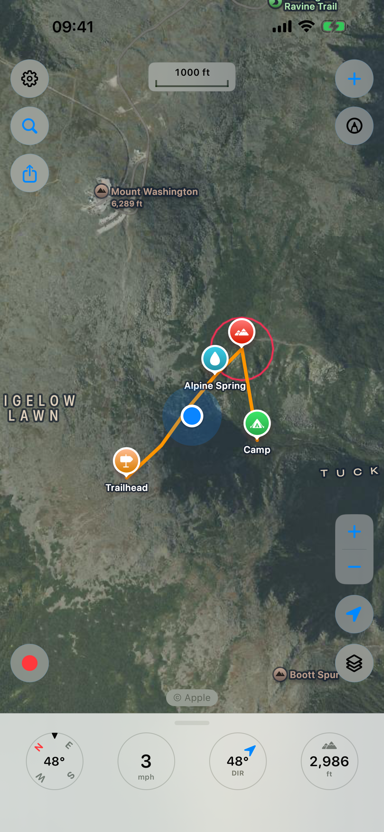
Trailseek is an offline GPS app for hiking and backcountry travel. It records your track, marks waypoints, shows where you are on topographic and satellite maps, and points you back to any spot. Your location and data stay on your device.
Maps
- Free maps with no account: Apple Maps, satellite, hybrid, OpenStreetMap, OpenTopoMap, and USGS Topo.
- A 3D terrain option adds relief to the Apple maps.
- Download USGS Topo areas and use them with no signal.
- Turn on a coordinate grid for latitude and longitude, UTM, or MGRS and USNG.
Waypoints
- Drop a waypoint at the map center, your location, or a long press.
- Set a name, an icon, a color, and a note.
- Attach photos from the camera or your library.
- Search and sort the list.
Tracks
- Record distance, time, speed, and elevation.
- Elevation comes from the barometer and GPS together.
- Recording continues with the screen off.
- Review a saved track's stats and elevation profile.
Navigation
- Follow a compass arrow to a waypoint, with distance, bearing, and ETA.
- It uses GPS and the compass, so it works with no signal and no map.
Coordinates
- Show your position as decimal degrees, degrees decimal minutes, or degrees minutes seconds.
- UTM and MGRS/USNG are always there.
- Tap a value to copy it.
GPX and sharing
- Import and export waypoints and tracks as GPX.
- Share a waypoint or track as a file, plain coordinates, or a maps link.
Drawing
- Draw on the map with Apple Pencil on iPad or a finger on iPhone.
- Drawings stay fixed to the ground as you pan and zoom, and share between devices.
iPad
- The map fills the screen and the panels open as popovers.
Apple Watch
- Record a track, mark and browse waypoints, and navigate from your wrist.
- See your track and waypoints on the watch map.
- Waypoints and tracks sync with your iPhone.
More
- A ruler measures distance and bearing between two points.
- Sunrise, sunset, moonrise, moonset, and the moon phase for your location.
- A trip computer tracks distance, moving time, and average speed.
Privacy
- No account, no sign-in, no ads, and no tracking.
- Your tracks, waypoints, photos, and location stay on your device. Trailseek does not collect them.
ストアランキング
ストアランキングは、GoogleとAppleが設定した複数のパラメータに基づいています。
業界別 ウェブサイトカテゴリーで
米国--
ナビゲーションで
米国--
Trailseek8月 31, 2026