

You’ve hit your search limit
Start your free trial to keep exploring full traffic and performance insights.
Get StartedMountain Visibility Forecast análises de aplicativos para 4 de outubro

Mountain Visibility Forecast
- Leah Gerber
- Apple App Store
- Pagos
- Clima
Some days you can't tell from the window whether the mountain is out or that's just bright gray sky.
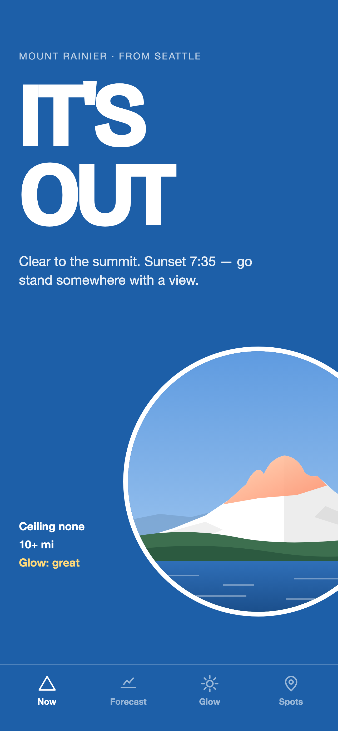
Open this and it says one thing: IT'S OUT, PARTLY OUT, or NOT TODAY. Under that, the reason. How low the cloud is sitting over you, whether the summit itself is in cloud, how far the air is letting you see, whether wildfire smoke has drifted in.
Seven mountains. Mount Rainier and the Olympics from Seattle, Mount Hood and Mount St. Helens from Portland, Mount Baker from Vancouver, Denali from Talkeetna, and Mount Angeles from Port Angeles and the Strait. The app picks the one nearest you, or you pick.
The answer is computed, not collected. It reads aviation weather from the airports along your line of sight to the summit, and the cloud layers at the summit itself from the MET Norway model. Four things follow from that, and together they are why this app costs something.
It works with nobody else using it. There is no feed to wait on and nobody who has to be awake, so there is a real answer at 6am on a Tuesday in January, and an answer for Olympia and Hood River and Bellingham, not only for the big city.
It tells you about the next three days, not just this minute. Hour by hour, through daylight.
You pay once. No subscription, no ads, nothing to unlock later.
It collects nothing about you. Apple's privacy label on this app reads Data Not Linked to You.
Where you are changes the answer, so that is built in. A Tacoma reading uses Tacoma's own overhead cloud and its 42-mile sightline, not Seattle's 60. On the morning you're the one clouded in, it tells you who isn't: "It's out from Tacoma, 26 miles off."
WHAT'S IN IT
Now. The verdict for your part of the region, with the reason underneath. Forty-two regions across the seven mountains.
Forecast. The next three days, daylight hours, hour by hour.
Glow. Every upcoming sunrise and sunset, graded. It splits cloud by height, because a low deck hides the mountain and high cloud catches the color. That is how you tell a good alpenglow from a gray one before you set the alarm. When the summit is in cloud, the grade is Skip.
Spots. Viewpoints for each mountain, each with the reading from its nearest stations, sorted by distance from you, tap for directions.
Moon. Its phase every day, and on a clear night how long it stays up.
Volcano status. For Rainier, Hood, Baker and St. Helens, the current USGS alert level sits at the bottom of the screen.
After dark it goes dark. Instead of telling you to go look, it tells you when first light is.
Notifications are optional and rare: one when the mountain comes out, one when the light is about to be good, never at night. There is no account, anywhere.
WHAT IT ISN'T
This is a forecast, not a camera. There are no photos and no webcams in it. It reads instruments and models and gives you an honest read of the sky between you and the mountain, and some days it will be wrong. Denali is the hardest of the seven: airport instruments stop measuring cloud around 12,000 feet, and the summit is 20,310. Above that line the app is reading a model, and it says so.
PRIVACY
One thing leaves your phone: a push token, so a notification can find you. Apple calls that a Device ID. It is not linked to you and it is not used to track you. If you tap "Use my location," your location is used on the phone to pick the mountain and the region, and never leaves it.
WHERE THE DATA COMES FROM
Aviation weather from NOAA. Forecast from MET Norway (CC BY 4.0). Wildfire smoke from NOAA. Volcano alert levels from USGS. Terrain from USGS.
Ranking da Loja
A Store Rank é baseado em vários parâmetros definidos pelo Google e Apple.
Todas as categorias em
Estados Unidos--
Clima em
Estados Unidos#27
Principais concorrentes e aplicativos alternativos
Aplicativos com alta probabilidade de serem usados pelos mesmos usuários, da mesma loja.

Neptune Weather

ITMO: Is Mount Rainier Out?

FOX 13 Seattle Weather App

Astrospheric
 Mountain Visibility Forecast VS.
 outubro 4, 2026