

10月8日 的 Danske Havne Info 應用程式分析

Danske Havne Info
- Jan Hansen
- Apple App Store
- 付費
- 旅行
Danish harbor info has been created so that you can easily find relevant information about Danish harbours.
* The app would be updated continuously, with new ports as well as data.
Find nautical information from the Danish Maritime Authority directly in the app now
Add Monitoring over a waterway and get the latest warnings in notification
updated 3 times daily
Functions you will find under each Port / Marina are:
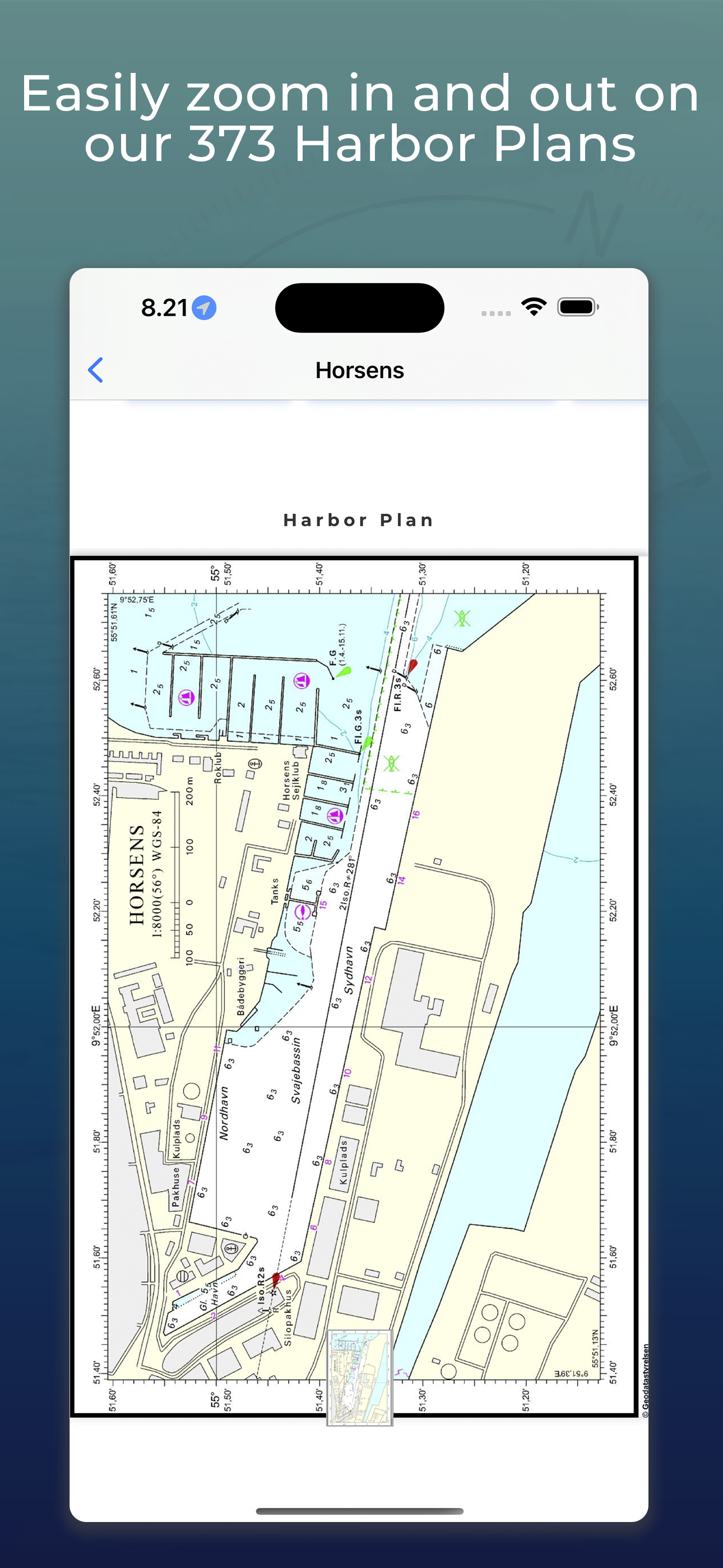
Ports Name, Telephone number, Mobile number, Position, Largest ships, website, E-Mail, Lyngby Radio, S.O.K, Alarm, Police, 46 different Facilities, Motorhome, Defibrillator, Port plan map of the port, Large map function, Entry target, long wide depth. etc.
We reserve the right for errors and omissions, as well as discontinued telephone numbers. If you experience an expired phone number or other data, please contact us, thank you in advance.
If you are a harbor officer or responsible for a port, marina, yacht harbor and would like to make corrections to your port, please contact us, thank you in advance.
Filter Harbor Plans according to the size of your boat on the Harbor Plan List and the Harbor Plan Map. (NOTE. use only as "GUIDE")
1971 Danish Lighthouse with lighthouse character, Flame height, Lighthouse appearance etc. data on card
Find bridge data on 44 Danish bridges such as, VHF, Cables, navigation, regulations, power etc.
Find VHF channel overview and Channel overview of Danish Ports in the Port Service as well as the pilot service, coastal stations on MF etc.
Find Audio Signals for use between ships in sight of each other.
Find ship light info with illustrations
Beaufort wind force table.
Short Distance Measure distance on your next sailing trip in km and nautical miles
Find all Signal flags with meaning as well
find the Danish Maritime Authority's Markings of Danish Waters in our app under signal flag.
Find Location at the 12 stations Dansk Søredingsselskab has in Denmark with phone number and address map and location and area of operation.
Use our Location Log
When you're ashore, you can save your position on your bike or inflatable boat so you can easily find your way back, or simply save your favorite places you've visited
or plot use it as Captain's log
Dansk Havne Info ship light image upload to Machine Learning!
Do you want to help improve Danske Havne Info? Help us collect images of sailing ships and boats with ship lights on so we can develop an advanced machine learning model to recognize ship lights automatically.
You can easily upload your images to 15 different categories of ship lights, which will contribute directly to our machine learning project. Once the model is ready, this feature will be available to all app users and make navigation even easier and safer for everyone on the water.
Participate and help create the functions of the future in Danske Havne Info!
Supports Dark Mode.
Geodatastyrelsen reproduction permit: 320-0333
商店排名
商店排名基於Google和Apple設定的多個參數。
所有類別 在
美國--
旅行 在
美國--


 Danske Havne Info VS.
 10月 8, 2026