Sie haben Ihr Suchlimit erreicht
Starten Sie Ihren kostenlosen Testzugang, um weiterhin alle Traffic- und Performance-Insights zu erkunden.
Los geht'sDroneDeploy - Mapping for DJI App-Analysen für 27. Januar
DroneDeploy - Mapping for DJI
- DroneDeploy
- Google Play Store
- Kostenlos
- Tools
IMPORTANT: Looking for DJI Mini 4 Pro, Mavic 3E, or other newer drone support? This Play Store app does not support these models. Please visit our Help Center to download the correct version directly: https://help.dronedeploy.com/
Mini 4 Pro Support: https://help.dronedeploy.com/hc/en-us/articles/33534052002583-DJI-Mini-4-Pro-Open-Beta
---
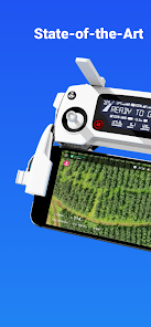
The DroneDeploy Flight app provides easy automated flight and data capture, enabling you to explore and share high-quality interactive maps, orthomosaics, and 3D models directly from your mobile device.
DroneDeploy is the ultimate app for a wide range of aerial imaging and mapping applications in construction, solar, agriculture, surveying, mining, insurance, inspection, and more. DroneDeploy has empowered users to map and analyze over 30 million acres in more than 160 countries.
Compatible with a range of DJI drones:
- Mavic 2 Pro / Zoom / Enterprise
- Phantom 4 Pro/Pro V2/Advanced
- Matrice 200 / 210 / 210 RTK V1/V2
Android 10+ Recommended
Automated Mapping for Beginners and Professionals:
- Easily create flight plans on any device
- Automate takeoff, flight, image capture, and landing
- Live stream First Person View (FPV)
- Disable auto-flight and resume control with a single tap
Image Processing and Analysis available on dronedeploy.com:
- Upload imagery from your drone’s SD card to www.dronedeploy.com to process high-resolution maps and 3D models
- Process Ground Control Points (GCPs) to create high-accuracy maps and models
- Export data in the formats you need
DroneDeploy - Mapping for DJI-Nutzungsrang
Das Ranking der Nutzung basiert auf dem Algorithmus von Similarweb, der aktuelle Installationen und aktive Benutzer:innen über einen Zeitraum von 28 Tagen berechnet.
Alle Kategorien in
Deutschland--
Tools in
Deutschland--
Benutzerinteressen und Top-Kategorien
Top-Kategorien und -Apps, die von DroneDeploy - Mapping for DJI Benutzern verwendet werden
Top-Wettbewerber und alternative Apps
Apps mit hoher Wahrscheinlichkeit, von denselben Benutzer:innen aus demselben Store verwendet zu werden.
ABAX Admin
Gaggle Paragliding, Ultralight
GPS Essentials
Bike Route Planner
Januar 27, 2026