Sie haben Ihr Suchlimit erreicht
Starten Sie Ihren kostenlosen Testzugang, um weiterhin alle Traffic- und Performance-Insights zu erkunden.
Los geht'sGps Parcela App-Analysen für 4. Februar
Gps Parcela
- Vanis Ltd
- Google Play Store
- Kostenlos
- Karten und Navigation
This app is primarily intended for all private landowners who want to have on their smartphones or tablets an album of all their land parcels with corresponding maps and other information so they can easily navigate to their land parcels.
The app is also intended for all real estate, precision agriculture and forestry professionals.
The app has a built-in NTRIP client that allows you to connect to a GNSS receiver using Bluetooth, and to connect to CORS - reference GNSS stations network using Internet.
In this way, the NTRIP client provides centimeter GPS accuracy with RTK corrections.
The app receives location data (latitude, longitude and others) from two sources.
The first source is the built-in GPS receiver of the smartphone. However, the accuracy of GPS coordinates in this case varies between 1 and 3 meters, which is quite enough for navigation to your land parcel.
Another source is an external GNSS receiver that has the capability of RTK correction. In this case, the accuracy of the Gps coordinates is one centimeter, which is necessary to precisely locate the boundary points of your land parcel.
This app is based on the idea that all cadastral data (primarily coordinates) of your land parcel are visually available to you personally via the Internet on the geoportal of your country.
However, there is no possibility that any app has a free access to cadastral data of all geoportals in Europe.
Therefore, with a little effort and with our help, you can type into this app the coordinates that you have read on the geoportal. Definitely this is the most precise way to define the boundaries of your land parcel so that you can use all features of this app.
For the purpose of this app, the land parcel is any land having its own boundaries defined by corners. Most often, the land parcel can be a cadastral parcel, but it can also be part of an agricultural plot where you have for example planted apples. The corner points are defined with GPS (WGS84) coordinates known as latitude and longitude.
Also the corner points can be defined in other coordinate reference system provided by your geoportal. You can read the coordinates from the corresponding geoportal map.
App Features:
Identification of land parcels, cadastral parcels.
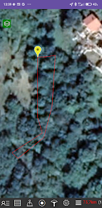
Display your land parcels on a map on your smartphone.
View the distance between the smartphone and the land parcel.
View your current smartphone location on the map.
Read the current GPS coordinates.
Improved accuracy of the current GPS coordinates reading.
Create a land parcel by entering the coordinates.
Update the entered coordinates.
Download the cadastral parcel coordinates from our web server.
Transformation from reference coordinates to Gps (WGS84) coordinates.
Get the land parcel area.
Get the length and compass direction of each parcel line.
Save the land parcel files in your local smartphone storage.
Language support for English, German, Italian, Croatian, Slovenian, Serbian, Czech, Slovak, Polish, Spanish, Portuguese, French.
Support for the coordinate systems and geoportals in the following countries: Austria, Belgium, Bosnia and Herzegovina, Bulgaria, Croatia, Czech Republic, Estonia, France, Germany, Italy, Latvia, Lithuania, Montenegro, North Macedonia, Poland, Portugal, Serbia, Slovakia, Slovenia, Spain, Switzerland and Europe.
Backup and restore.
Centimeter GPS accuracy with RTK correction using the built-in NTRIP client.
Precise navigation to the parcel corners.
Support for RTK GNSS receiver
Gps Parcela-Nutzungsrang
Das Ranking der Nutzung basiert auf dem Algorithmus von Similarweb, der aktuelle Installationen und aktive Benutzer:innen über einen Zeitraum von 28 Tagen berechnet.
Alle Kategorien in
Vereinigte Staaten--
Karten und Navigation in
Vereinigte Staaten--
Top-Wettbewerber und alternative Apps
Apps mit hoher Wahrscheinlichkeit, von denselben Benutzer:innen aus demselben Store verwendet zu werden.
Südtirol Fishing
Rome Travel Guide
Bike Route Planner
Februar 4, 2026