Sie haben Ihr Suchlimit erreicht
Starten Sie Ihren kostenlosen Testzugang, um weiterhin alle Traffic- und Performance-Insights zu erkunden.
Los geht'sHurricane & Typhoon Track App-Analysen für 21. Januar
Hurricane & Typhoon Track
- H & Y Studio
- Google Play Store
- Kostenlos
- Wetter
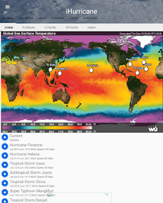
Hurricane & Typhoon Track allows you to keep track of tropical storm ,Typhoon,and hurricane activity in the Global Ocean basins. gives you the most up to the minute and reliable hurricane & Typhoon path,Tracking Map,coordinates data,Satellite Images, Computer Models,Warning Information and high resolution Satellite maps... with data provided by 22,000+ trusted or official weather stations all over the world.
Also, you will be able to stay informed on the status of the local and national power grid and surge probability.
Here are the key highlights of this application...
* Quick overview of active hurricanes, tropical storms, depressions, and other cyclones
* Get real-time Hurricane & Typhoon Tracking
* Emergency Shelters
* Tap on any map to view full screen, with pinch-to-zoom, drag, and scroll support, even during loop playback
* Current Storm Location
* Computer Models
* Forecast cones (5-day uncertainty track), wind speed probability, storm surge maps (when available), and GOES Floater satellite imagery
* Storm Surge Probability
* Optional Forecast Model Viewer Add-On: View forecast models (also known as spag models) for active systems on an interactive map complete with panning, zooming, and individual model point information when tapped. Features selectable models, start time, and run length
* Sharing of screenshots with any app that supports it (Facebook, Twitter, etc.)
* Multiple types of regional summary maps and satellite loops to choose from (full list below)
* Road Maps
* Historical Map
* Per-storm advisory & discussion text from the experts at the National Hurricane Center, Public & Marin Advisory
**************************************
all the data is just from National Oceanic and Atmospheric Administration, (NOAA)
Stay informed about the latest tropical systems in the Atlantic,Pacific,Indian Ocean and Caribbean . Get the most recent maps and forecast details about active storms.
Hurricane & Typhoon Track-Nutzungsrang
Das Ranking der Nutzung basiert auf dem Algorithmus von Similarweb, der aktuelle Installationen und aktive Benutzer:innen über einen Zeitraum von 28 Tagen berechnet.
Alle Kategorien in
Vereinigte Staaten--
Wetter in
Vereinigte Staaten--
Top-Wettbewerber und alternative Apps
Apps mit hoher Wahrscheinlichkeit, von denselben Benutzer:innen aus demselben Store verwendet zu werden.
St. Cloud Live StormTRACKER
Weather for Wear OS
Windfinder Pro: Wind & Weather
Emergency: Severe Weather App
Januar 21, 2026