

You’ve hit your search limit
Start your free trial to keep exploring full traffic and performance insights.
Get StartedAnalyse de l'application map-creator pour le 24 août

map-creator
- Kilian Eisenegger
- App Store Apple
- Payant
- Photo & Vidéo
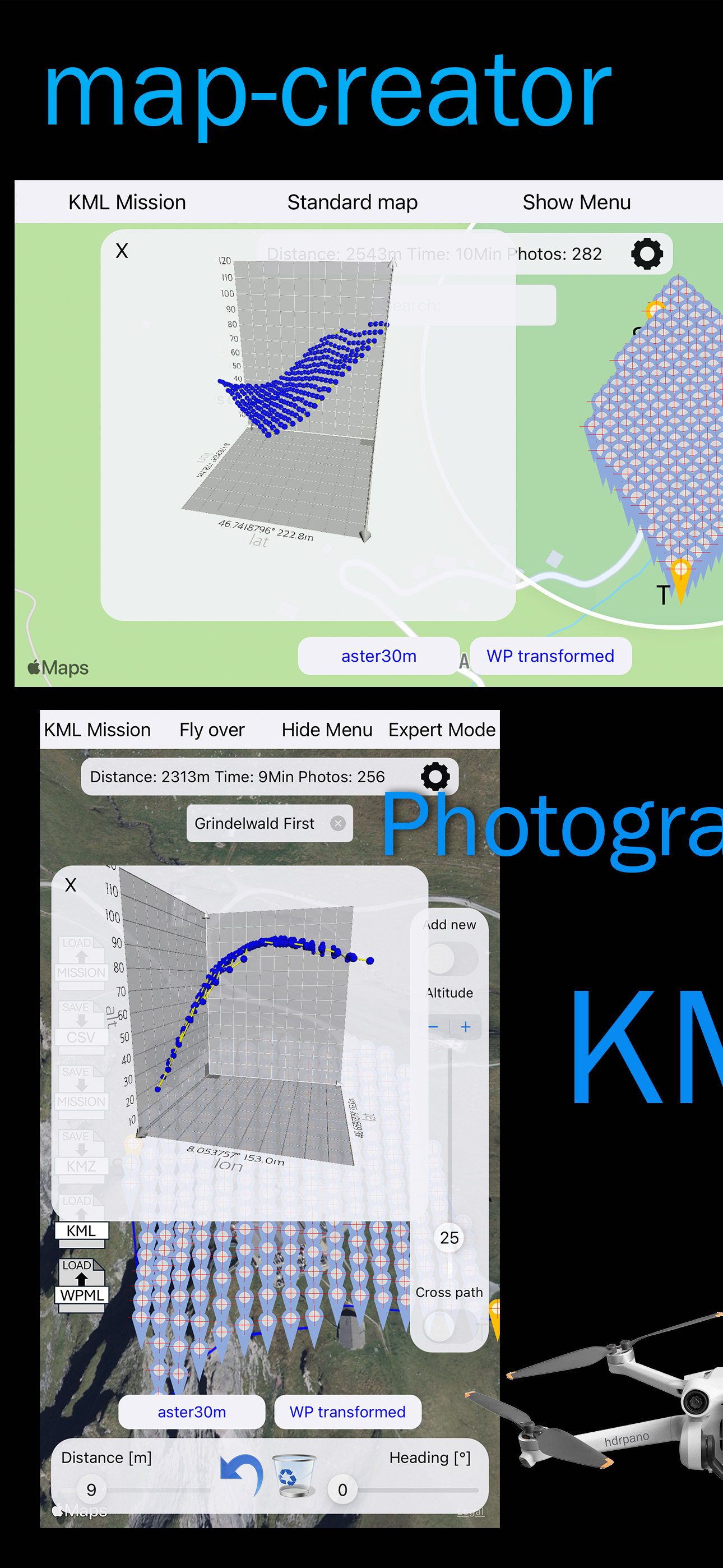
Photogrammetry & AGL Mission Planner
Map Creator is a professional mission planning tool for photogrammetry, mapping and inspection flights.
Create precise AGL (Above Ground Level) flight missions directly on the map with advanced elevation support and flexible grid geometries.
Mission Planning
Create, edit and visualize waypoints directly on the map:
- Flat 2D or true AGL missions with 3D elevation and triangulation
- Cross-grid and custom flight paths
- Adaptive pitch based on altitude
- Smooth flight path algorithms for safe and efficient missions
Mission Types
- 2D / AGL Grid Mission (cross paths supported)
- Orthophoto Cross Mission with elevation
- 3D Spherical Mission (double helix, adaptive pitch)
- Circle Mission with adaptive pitch
- Inception Mission
- Vertical Mission with elevation support
Elevation & Terrain Data
High-quality terrain data ensures precise AGL calculations for every waypoint:
Built-in elevation datasets (OpenTopoData):
- ASTER 30 m
- EU-DEM 25 m
- NED 10 m (North America)
- GPXZ
Advanced users:
- Local DEM server support (OpenTopoData, Swisstopo 2 m / 0.5 m, GeoTIFF)
- Per-waypoint AGL transformation using high-resolution terrain models
Import & Export
Maximum compatibility with industry-standard tools:
Export (high-resolution elevation for all waypoints)
- KMZ for DJI Pilot & DJI Fly
- KML for Google Maps & Map Creator import
- CSV for hdrpano, Litchi & Litchi Pilot
Import
- KML to add precise AGL to existing missions
- KMZ / WPML from DJI Pilot 2, DJI Fly or other providers
DJI Fly / Pilot Workflow
- Direct KMZ mission transfer using my DJIKMZInjector macOS/Windows
- Seamless integration with DJI remote controllers
iCloud Support
- Save and load missions via iCloud
- CSV-based mission storage for easy sharing and versioning
Compatibility
- CSV format fully compatible with Litchi Flight Hub
- Optimized for iOS 26 and macOS 26
Credits
Elevation data powered by OpenTopoData
Thanks to Andrew for providing open elevation services.
More details:
Visit map-creator.com
Classement dans le store
Le classement des stores est basé sur plusieurs paramètres définis par Google et Apple.
Toutes les catégories dans
États-Unis--
Photo & Vidéo dans
États-Unis--
Principaux concurrents & apps alternatives
Applications ayant une forte probabilité d'être utilisées par les mêmes utilisateurs, à partir du même store.

QRCode Clock

AI Photo Editor & Enhancer

Newsflare

Image Size: Photo Resizer
 map-creator VS.
 août 24, 2026