

You’ve hit your search limit
Start your free trial to keep exploring full traffic and performance insights.
Get StartedAnalyse de l'application Grid North pour le 11 octobre

Grid North
- Mohamed Alshamsi
- App Store Apple
- Payant
- Navigation
Grid North is offline-first field navigation built around military and survey coordinate systems, not a consumer maps app with a grid bolted on.
Made for land navigators, ROTC and cadets, hunters, ranchers, search-and-rescue volunteers, surveyors, hikers and backcountry travelers who need MGRS or UTM and can't count on a signal.
TRIP MODE
• Start a trip in one tap and watch your trail build live on the map
• Sunset countdown that tells you whether you'll get back before dark
• "Get me back": an arrow that follows your own trail home
• Falling-pressure storm warning from your phone's barometer
• Battery forecast and a Save mode that stretches your charge
• "I'll be back by" alarm, with a last-known-position screen you can read out over a radio
• Finish with a recap of your trail, then share it as a picture
RANKS AND BADGES
• 20 badges across Easy, Normal, Challenge and Mission tiers
• 8 ranks, from Recruit to Legend: finish a tier of badges to move up
• All worked out on your phone from your own trips. Nothing is uploaded or compared with anyone.
CORE NAVIGATION, NO SIGNAL REQUIRED
• Live position in MGRS, USNG, UTM, Lat/Long and OSNG in large, high-contrast type
• Five datums: WGS 84, NAD 27, OSGB 36, AGD 66, ED 50
• A live compass dial with an arrow, bearing, distance and terrain-aware ETA to your destination
• AR Navigate: point your camera and see your waypoints at their real bearing and distance
• Local and Zulu time
WAYPOINTS
• Mark your position in one tap, type a coordinate in any supported format, project a point by distance and bearing, or say "mark waypoint" hands-free
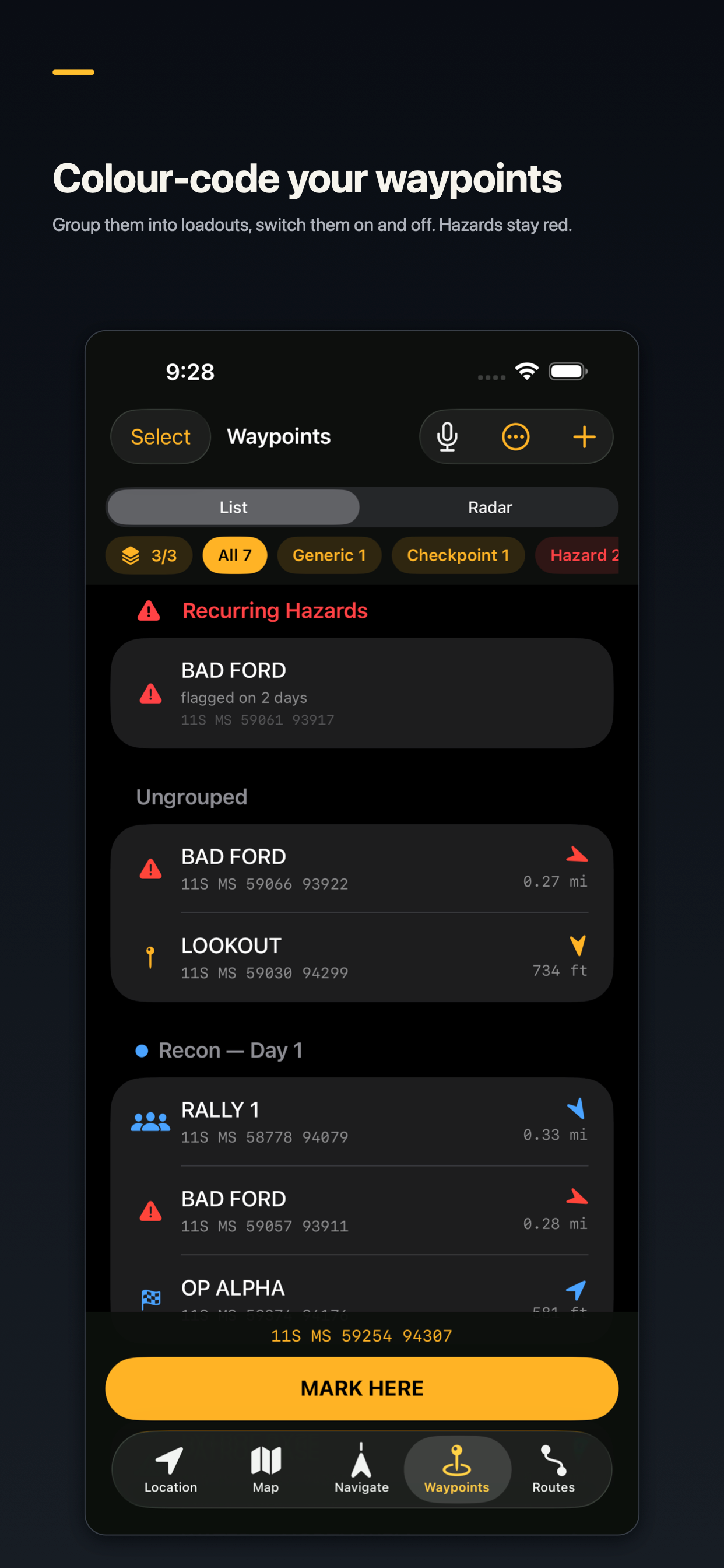
• Loadouts: group waypoints, give each group a colour, and switch groups on and off
• Radar view of every waypoint around you
• Daylight check: can you reach a waypoint before dark?
• Hazard, checkpoint, water, rally, campsite and vehicle categories, with repeat hazards flagged automatically
MAPS AND ROUTES
• A map with an MGRS/UTM grid overlay, a crosshair for dropping waypoints, and a ruler that snaps to your points
• Plan multi-stop routes with cumulative distance and elevation
• Terrain-aware route suggestions that favor gentle gradients
TRACK RECORDING
• Records a breadcrumb trail in the background, even with the screen locked
• GPS noise is filtered out, so sitting still stays at zero and distance and climb stay accurate
• Replay any trip on the map and get a plain-language summary generated on your device
APPLE WATCH
• Your MGRS position and a Mark Waypoint button on your wrist
• Bearing and distance to your destination
• A radar of nearby waypoints, zoomed with the Digital Crown
• A watch face complication
PRIVACY
Your location, waypoints, routes and tracks stay on your device. There is no account, no login, no ads, no analytics and no trackers. Map imagery needs a connection; everything else works offline.
LANGUAGES
English and Arabic, with full right-to-left layout.
One purchase. No subscription.
Classement dans le store
Le classement des stores est basé sur plusieurs paramètres définis par Google et Apple.
Toutes les catégories dans
États-Unis--
Navigation dans
États-Unis--
Grid Northoctobre 11, 2026