You’ve hit your search limit
Start your free trial to keep exploring full traffic and performance insights.
Get StartedFHP GIS App analisi dell'app per 18 gennaio
FHP GIS App
- Farm and Home Publishers LTD INC
- App Store di Apple
- Gratis
- Navigazione
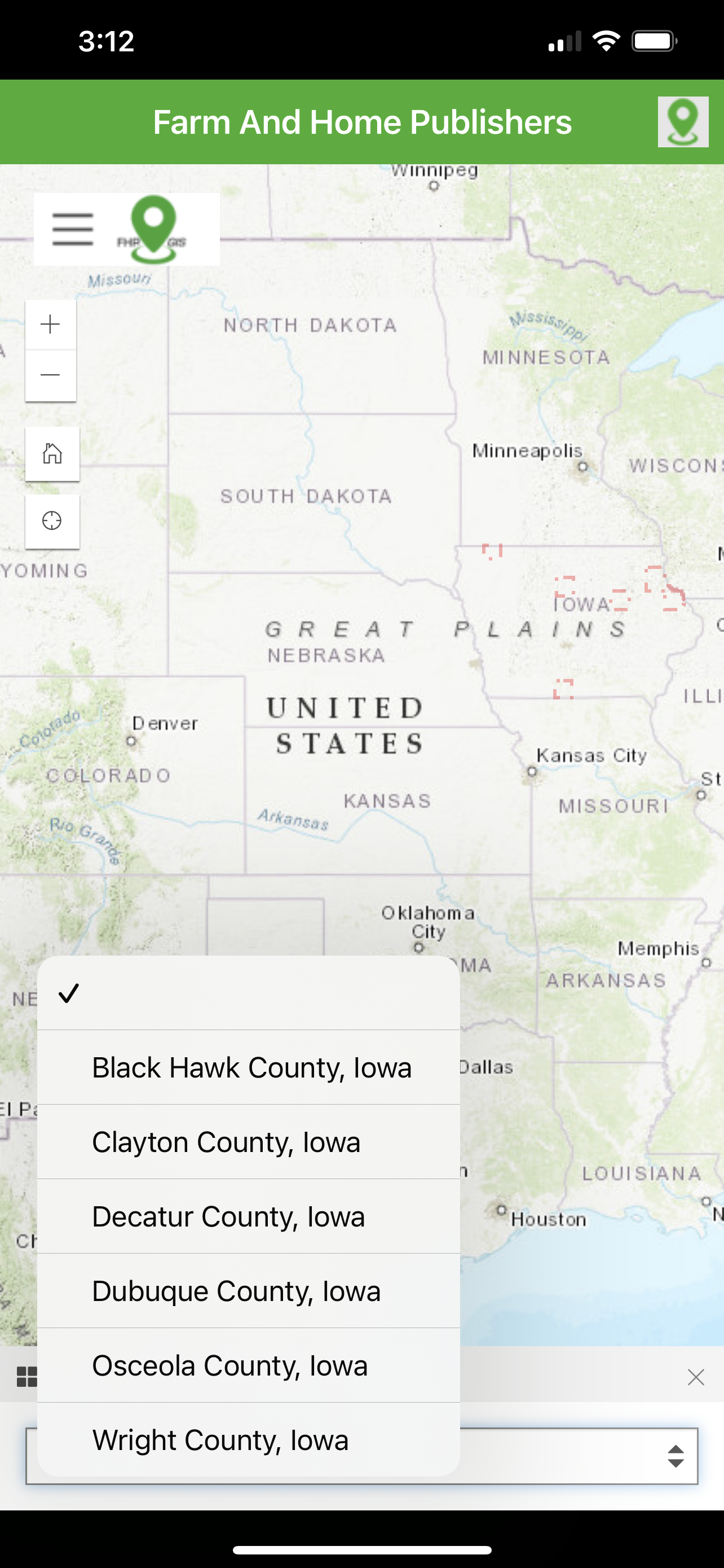
The FHP GIS App provides a nationwide map-based view of parcel boundary and owner
information across over 3,200 counties (99% of the US). In addition, the App also provides
access to residential addresses and contact information in over 500 counties, primarily across
the Midwest. Local, regional, and national businesses are shown on the map and are invited to
be represented in the App alongside other organizations.
Several unique data sets are included in the FHP GIS App. These include:
- Nationwide parcel ownership data, including addresses, property values, owner
information, and much more.
- Regional geocoded residential data, including contact information
- Businesses and organizations, as geocoded locations and scrolling banners
- Public Land Survey System (PLSS) Townships and Sections, nationwide
- Nationwide US Census Subdivisions (Civil Townships and Census County Division (CCDs))
- Nationwide counties and states
- Worldwide satellite imagery
- Worldwide street and administrative areas
- Nationwide National Agriculture Imagery Program (NAIP) imagery in real-color
- Nationwide National Agriculture Imagery Program (NAIP) imagery in infrared-color
- Real-time traffic feeds
- Real-time weather feeds
- Real-time natural disaster feeds
- More.
Additionally, several unique tools and functions are included in the FHP GIS App. These include:
- A custom search tool, by parcel owner, resident name, business owner, as well as
searching by location, place name, or address
- A secure login experience manages the user’s map experience.
- Filtering the user experience, specifically on Parcels and Resident data, to select
counties based on accessible counties to that particular user
- Map interactions are customized to retrieve information from select layers through
interactive click events
- Layers are interactively turned on and off in the map view
- A map key/legend is dynamically generated based on the visible map layers
- Measuring tools to help determine area, length, and XY location, in several different
unit-of-measurement options
- Drawing tools to allow temporary markups and notes
- Additional layers accessible from external web feeds
- Bookmarks to establish stored locations and zoom extents for the user’s map view
- Screenshot and print-to-file for storing information for later
For the customer already familiar with Farm and Home Publisher’s Plat Books, the FHP GIS App
extends the printed books and provides a digital, interactive view of the same map contents. In
addition, it adds more layers and will be ever-expanding to incorporate the needs and wishes of
the FHP community.
Classifica degli store
La classifica del store si basa su diversi parametri stabiliti da Google e Apple.
Tutte le categorie in
Stati Uniti--
Navigazione in
Stati Uniti--
Principali concorrenti e app alternative
App con un'alta probabilità di essere utilizzate dagli stessi utenti, provenienti dallo stesso store.
ParcelQuest Mobile
Property Line Finder - Parcel
i-Hunting : GPS Maps App
LandMap Property Line Finder
gennaio 18, 2026