You’ve hit your search limit
Start your free trial to keep exploring full traffic and performance insights.
Get StartedDroneDeploy - Mapping for DJI analisi dell'app per 28 gennaio
DroneDeploy - Mapping for DJI
- DroneDeploy
- Google Play Store
- Gratis
- Strumenti
IMPORTANT: Looking for DJI Mini 4 Pro, Mavic 3E, or other newer drone support? This Play Store app does not support these models. Please visit our Help Center to download the correct version directly: https://help.dronedeploy.com/
Mini 4 Pro Support: https://help.dronedeploy.com/hc/en-us/articles/33534052002583-DJI-Mini-4-Pro-Open-Beta
---
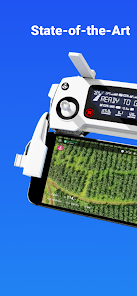
The DroneDeploy Flight app provides easy automated flight and data capture, enabling you to explore and share high-quality interactive maps, orthomosaics, and 3D models directly from your mobile device.
DroneDeploy is the ultimate app for a wide range of aerial imaging and mapping applications in construction, solar, agriculture, surveying, mining, insurance, inspection, and more. DroneDeploy has empowered users to map and analyze over 30 million acres in more than 160 countries.
Compatible with a range of DJI drones:
- Mavic 2 Pro / Zoom / Enterprise
- Phantom 4 Pro/Pro V2/Advanced
- Matrice 200 / 210 / 210 RTK V1/V2
Android 10+ Recommended
Automated Mapping for Beginners and Professionals:
- Easily create flight plans on any device
- Automate takeoff, flight, image capture, and landing
- Live stream First Person View (FPV)
- Disable auto-flight and resume control with a single tap
Image Processing and Analysis available on dronedeploy.com:
- Upload imagery from your drone’s SD card to www.dronedeploy.com to process high-resolution maps and 3D models
- Process Ground Control Points (GCPs) to create high-accuracy maps and models
- Export data in the formats you need
Ranking di utilizzo di DroneDeploy - Mapping for DJI
Il ranking di utilizzo si basa sull'algoritmo di Similarweb che calcola le installazioni correnti e gli utenti attivi su un periodo di 28 giorni.
Tutte le categorie in
Stati Uniti--
Strumenti in
Stati Uniti--
Interessi degli utenti e categorie principali
Le categorie principali e le app utilizzate dagli utenti di DroneDeploy - Mapping for DJI
Categorie principali
Affinità
Le migliori app all'interno della categoria
Altri applicazioni
17%
12%
11%
9%
Principali concorrenti e app alternative
App con un'alta probabilità di essere utilizzate dagli stessi utenti, provenienti dallo stesso store.
ABAX Admin
Gaggle Paragliding, Ultralight
GPS Essentials
Bike Route Planner
gennaio 28, 2026