You’ve hit your search limit
Start your free trial to keep exploring full traffic and performance insights.
Get StartedELECTRONIC NAUTICAL CHART SYMBOLS & ABBREVIATIONS análises de aplicativos para 15 de fevereiro
ELECTRONIC NAUTICAL CHART SYMBOLS & ABBREVIATIONS
- The Other Hat
- Apple App Store
- Pagos
- Navegação
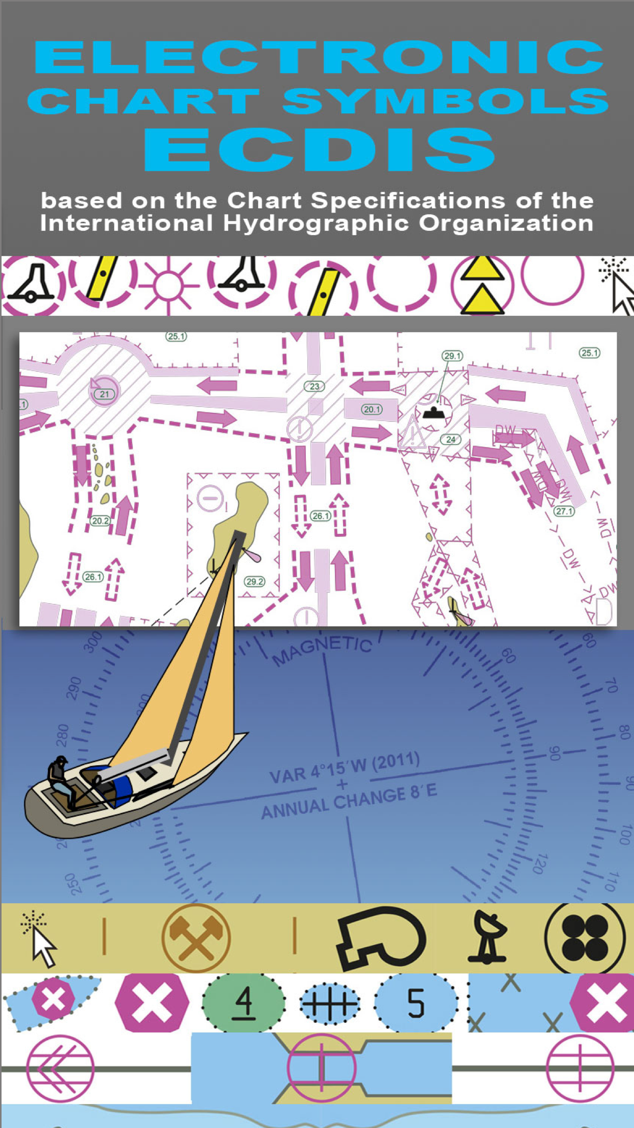
REFERENCE GUIDE TO THE SYMBOLS USED ON ELECTRONIC (ECDIS) NAUTICAL CHARTS SPECIFIED BY THE INTERNATIONAL HYDROGRAPHIC ORGANIZATION (IHO).
************ FEATURES and BENEFITS ************
- Perfect for reference, learning & revision
- Hi-res graphics
- Tap & Enlarge feature for greater detail
- Fully searchable index to all the symbols
- Always with you on your iPhone or iPad
- No internet connection needed
************ Plus FREE Bonus Content from "Safe Skipper" ************
"ELECTRONIC NAUTICAL CHART SYMBOLS & ABBREVIATIONS" provides quick reference to the "INT 1" symbols specified by the International Hydrographic Organization (IHO).
There are five main sections in this app, each with lettered sub-sections organized into categories to guide users through the hundreds of symbols. The main sections are:
GENERAL - chart layouts, positions, distances, directions and compass.
TOPOGRAPHY - landmarks, ports and coastal land features.
HYDROGRAPHY - tides, currents, depths, nature of the seabed, underwater obstructions, tracks, areas, limits and hydrographic terms.
NAVIGATION AIDS & SERVICES - lights, buoys, fog signals, radar, radio, services and small craft facilities.
INDEX & ABBREVIATIONS - international abbreviations and index to symbols and abbreviations.
************* FREE Bonus Content from "Safe Skipper" *****************************
A bonus section has tips on how to deal with emergencies including: Abandon ship; Dismasting; Distress Signals; Engine Failure; Fire Fighting; Flares; Getting a tow; Helicopter rescue; Holed hull; Man overboard; Medical emergency; Mayday; Panpan; Securité.
INDEX The index is an A-Z of symbols and abbreviations and enables the user to quickly look up the symbols and see them in context with others in the same categories.
This app is based on the United Kingdom Hydrographic Office's print publication "Chart 5011 (INT 1) EDITION 2" Admiralty Charts Publication and "Chart No.1 United States of America Nautical Chart Symbols, Abbreviations and Terms".
We have an on-going program of marine navigation and boating safety apps, so please contact us with any ideas or features that you would like to see included.
Safe boating!
Ranking da Loja
A Store Rank é baseado em vários parâmetros definidos pelo Google e Apple.
Todas as categorias em
Estados Unidos--
Navegação em
Estados Unidos--
Principais concorrentes e aplicativos alternativos
Aplicativos com alta probabilidade de serem usados pelos mesmos usuários, da mesma loja.
EZ Nautical Almanac
Maneuvering Board
Mate4Mate
SEAiq
fevereiro 15, 2026