You’ve hit your search limit
Start your free trial to keep exploring full traffic and performance insights.
Get Started13 Ocakiçin WinGPS Marine uygulama analizi
WinGPS Marine
- Stentec Software B.V.
- Apple App Store
- BOŞTA
- Navigasyon
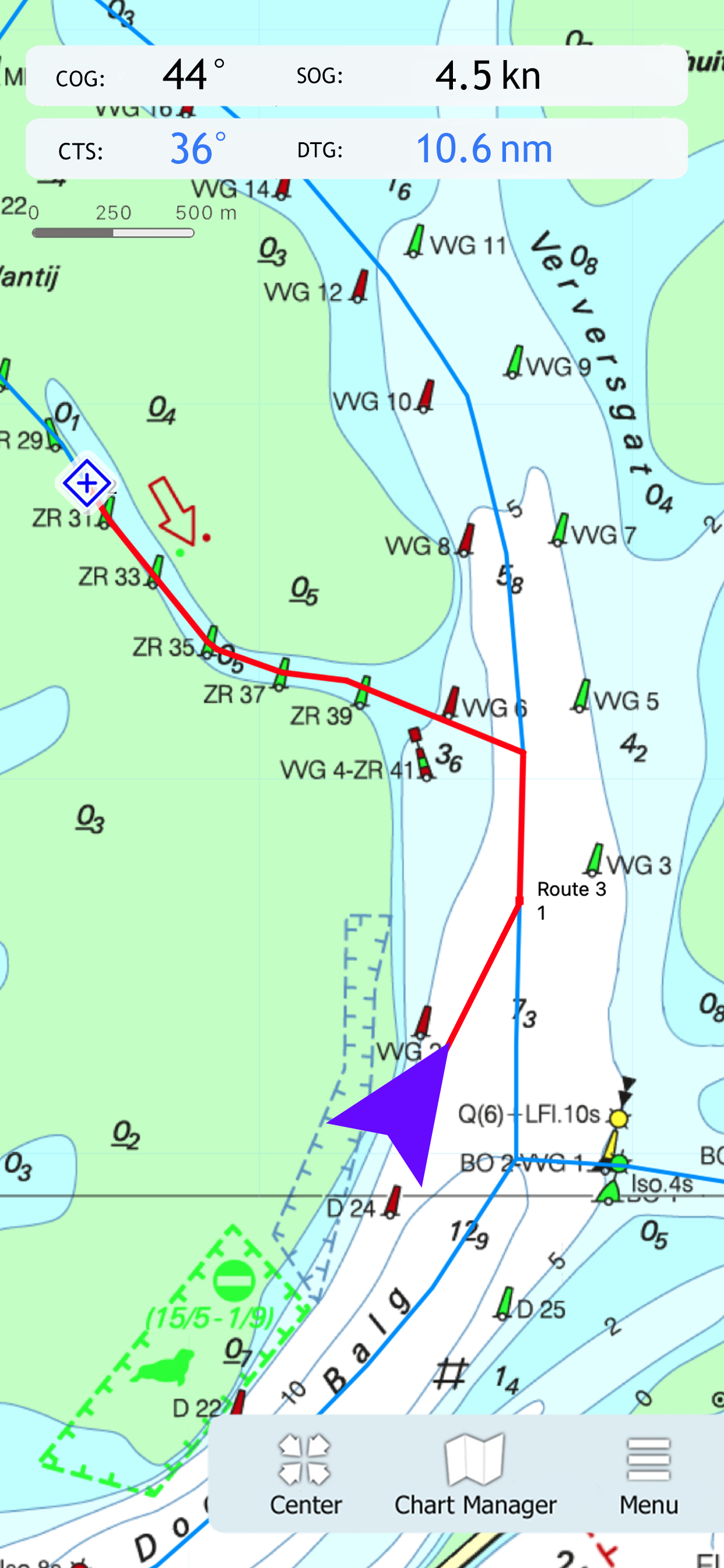
Ideal for navigation onboard of your sailing yacht, motorship, canoe or longboat:
- Always know where you are, how fast you go and what your course is using a GPS receiver (internal or Bluetooth).
- Download the chart of your sailing area and check the current depths, buoys and other nautical information.
- Place a navigation waypoint and sail to your destination using the course line, Course to Go and Distance to Go.
- Waterway network: View the information of the bridges, locks and waterways.
- View your sailed track on the chart.
- Show the distance circles around your GPS position.
At the first start-up of the app, you will be asked to log in with your account. The free default online charts from Apple are available in the app for orientation. The DKW-charts of 2018 and newer, which are connected to your account, can be downloaded directly in this app and be used for navigation.
Mağaza Sıralaması
Mağaza Sıralaması, Google ve Apple tarafından belirlenen birden fazla parametreye dayanmaktadır.
Tüm kategoriler içinde
Amerika Birleşik Devletleri--
Navigasyon içinde
Amerika Birleşik Devletleri--
En İyi Rakipler & Alternatif Uygulamalar
Aynı mağazadan, aynı kullanıcılar tarafından kullanılma olasılığı yüksek olan uygulamalar.
PRO CHARTS - Marine Navigation
AIS Maps: Marine & Lake charts
SeaNav
Aqua Map Boating
Ocak 13, 2026