You’ve hit your search limit
Start your free trial to keep exploring full traffic and performance insights.
Get StartedAnalyse de l'application Horsetrails pour le 27 janvier
Horsetrails
- Sensetrails Sarl
- App Store Apple
- Payant
- Navigation
Tired of using the same trail with your horse over and over again ? You are willing to discover new horse trails ? You would like to share your favorite trails with your friends ? Horsetrails is the first iPhone application developed specifically for horseback riders.
Horsetrails is a mobile application designed for horseback riders willing to record their preferred trails or discover new trails.
Trails and maps are stored on your device and work offline (no data connection necessary). You can use the application without GSM coverage or in a foreign country.
Recording functionality
With a click, record your trail. Once the trail is complete it is stored on your phone and you can share it by email with your friends or through our public database on our Horsetrails web platform (www.sensetrails.com/HorseTrails) to share it with any other horse rider. You can comment your trail, define terrain type and/or rate trails published by others.
Official or Recommended trails
Official or recommended trails are available for download free of charge or for a minimal fee.
For Switzerland
- Parcours Equestres Conseillés du canton de Vaud (PEC)
- Association des Cavaliers de la région Arve et Lac (ACAL)
- Association des Cavaliers du Léman (ACL) (Soon)
- …
For France
- Trail of CDTE Auvergne
- Trail of Pays Sancerre/Sologne
- Trail of CDTE 44
- Trail of l’Ain à Cheval
- Trail Equirando à Lignière (CHER)
- Trail of Equi’Sioule (Val de Sioule)
More trails will be added on a regular basis.
Maps
We offer free open source maps for the entire world (from openstreetmap.com) and free digital elevation data (for terrain profile along the trail). We also offer commercial maps such as topographic maps and aerial images (satellite photos). Once downloaded maps are stored on your device and you don't need internet connectivity to use them (unlike many other map applications).
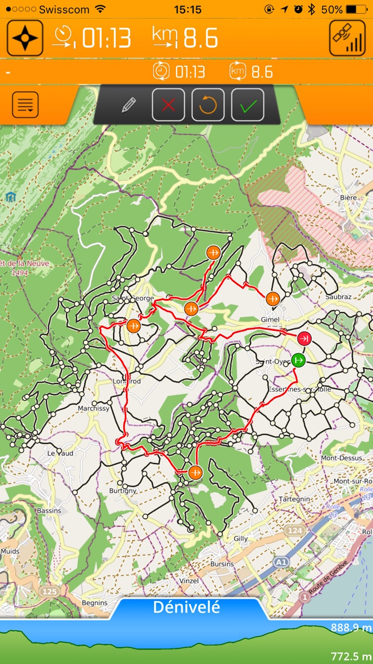
Trail information : time, distance, elevation
You are willing to know the time, distance and elevation of the trail before starting it ? We display all the information in the top bar and bottom elevation profile of the application.
A trail sharing platform
Open a free account on our horsetails platform to access trails shared by other horse riders. Share your own favorite trails.
Rate and comment other's trails and see comments on your own shared trails.
Take photos !
Along your trails, take photos of points of interest and find them on the map at the location where they were taken.
Extra features
Automatic map rotation to follow your orientation, horse riders code of conduct, and many others. Check by yourself :-)
Enjoy your rides !
Classement dans le store
Le classement des stores est basé sur plusieurs paramètres définis par Google et Apple.
Toutes les catégories dans
États-Unis--
Navigation dans
États-Unis--
Principaux concurrents & apps alternatives
Applications ayant une forte probabilité d'être utilisées par les mêmes utilisateurs, à partir du même store.
Galapagos Island Guide
Disway Trails
Baba Residences
Région Haute-Ajoie
janvier 27, 2026