

Solocator - GPS Field Camera 앱 분석 (10월 4일)

Solocator - GPS Field Camera
- Civi Corp Pty Ltd
- Apple App Store
- 유료
- 내비게이션
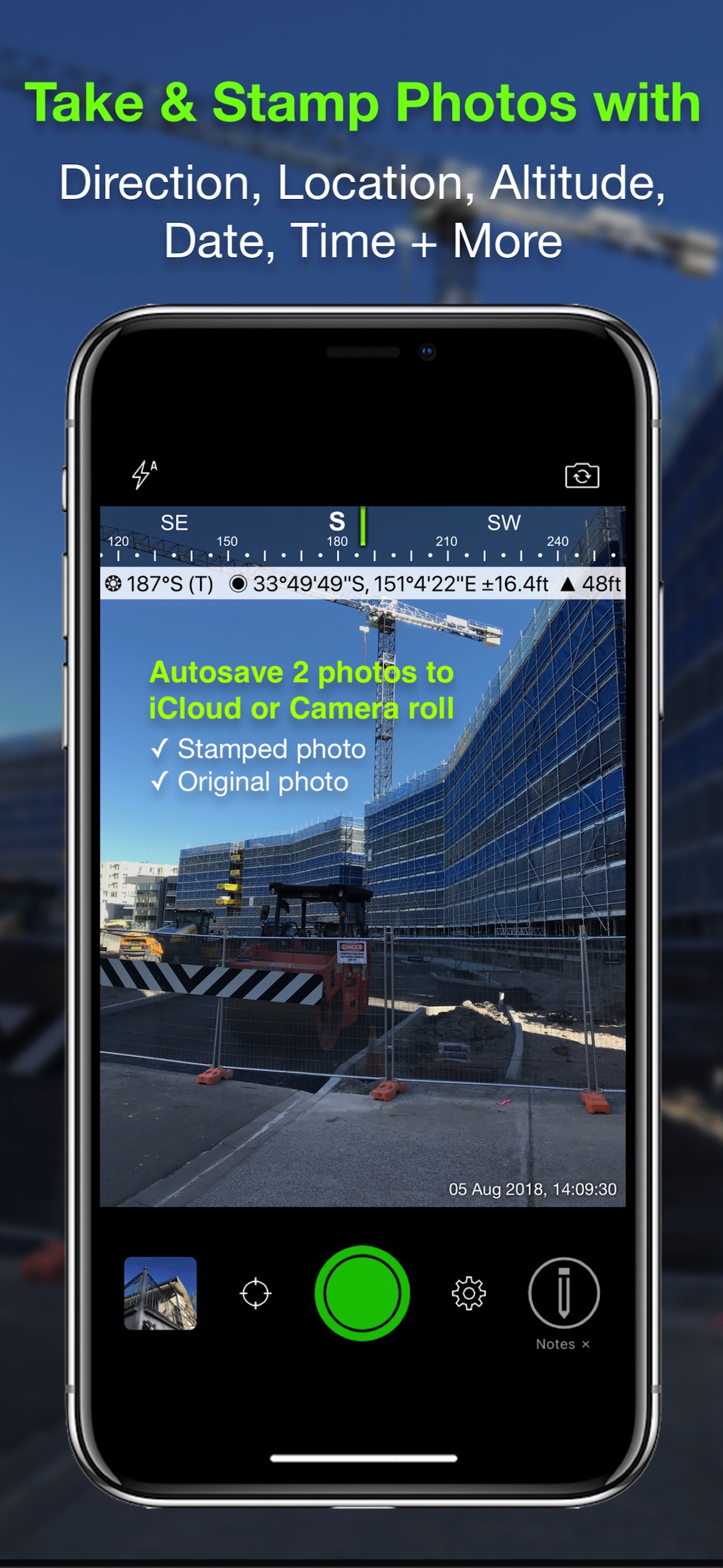
Solocator – The GPS Camera for Fieldwork and Photo Proof evidence. Overlay and stamp photos with location, direction, altitude, date & time taken. With the Industry Pack (in-app purchase), capture field notes including project name, photo description, company or username, and company logo.
Solocator is trusted by professionals, government agencies, and industries worldwide for reliable photo documentation.
TAILOR OVERLAY INFORMATION TO YOUR NEEDS
Capture & stamp on your photos:
+ GPS position (Latitude & Longitude in various formats) ± accuracy
+ UTM/MGRS coordinates (Industry Pack)
+ Street address (Industry Pack)
+ Direction – bearing
+ Altitude (MLS / HAE)
+ Tilt & Roll angles
+ Local date & time (based on GPS location)
+ Local time zone
+ UTC time
+ Compass display
+ Cardinal directions
+ Building facade direction, e.g. "North elevation"
+ Field Notes (Industry Pack)
+ Company Logo (Industry Pack)
AUTOSAVE PHOTOS TO iCLOUD & CAMERA ROLL
Autosave two photos at once: one stamped with the selected overlays and the other as an original high-resolution photo.
SORT, SEARCH, SHARE OR EMAIL
+ Photos are sorted by time, location, distance from current location and project name.
+ View photo direction and location in map view and navigate there.
+ Share photos individually or as a zip file via the share sheet.
+ Search for photos by date, date range or notes and street addresses.
+ Email photos including the following information:
- Exif metadata
- Compass direction
- GPS position ± accuracy
- Altitude
- Tilt & Roll
- Date & time taken
- Street address (Industry Pack)
- Cardinal Directions
- Elevation of building facade
- Links to maps so the receiver can navigate there easily
** INDUSTRY PACK ** (In-App Purchase) "One-off charge"
EDITABLE NOTES OVERLAY
Stamp photos with "Project name", "Description" & “Watermark”. The Project Name field can be used as a job or ticket number. The Watermark field is typically used for a company or username. You can also edit these fields later.
WATERMARK LOGO
Add your Company Logo to photos. Logo’s size, opacity, and position can be customised for both portrait and landscape photos. To get you started, a Solocator icon is included, which can be replaced.
CUSTOM EXPORT FILENAME
Define your photo export filename from a selection of fields: Project Name, Description, Watermark, Street Address, Date/Time, Number#, Custom text field, Photo type (original/stamped), and Coordinates (DD.dddddd, UTM, UTM Bands, MGRS).
AUTOSAVE OR EXPORT PHOTOS TO CLOUD STORAGE
Autosave original and stamped photos to Google Drive, Dropbox, and OneDrive (Personal & For Business), including SharePoint Sites and Teams. You can also save photos in date or project name subfolders - automatically.
PHOTO DATA in KML, KMZ & CSV
Along with photos, email or export photo data and notes in KML, KMZ or CSV formats. Both email and export buttons are customisable to suit your data requirements.
STREET ADDRESS & UTM/MGRS
Add street address to your overlay or use UTM/, UTM Bands & MGRS coordinate formats.
BATCH EDIT NOTES & OVERLAY FIELDS
Select photos from the library and edit Project Name, Description & Watermark fields in one go.
TRACK PHOTOS IN MAP VIEW
View photos by direction, the distance between photos, area of photos taken and distance to your added markers via imported KML files or dropped pins.
REFINE & LOCK GPS LOCATION
Ideal for those working in and around buildings; to improve your GPS location. You can also use it to lock the asset position you're photographing.
COMPACT VIEW
Switch off Compass, Building and Street modes and only show the GPS info bar for a more compact view.
VPP Customers: https://solocator.com/enterprise-app-for-mdms/
Terms of Use: https://www.apple.com/legal/internet-services/itunes/dev/stdeula/
스토어 순위
스토어 순위는 Google과 Apple이 설정한 여러 매개변수를 기반으로 합니다.
모든 카테고리 ·
미국#34
내비게이션 ·
미국#2


 Solocator - GPS Field Camera VS.
 10월 4, 2026