

10月14日 的 Alpine Quest: Tactical GPS Pro 應用程式分析

Alpine Quest: Tactical GPS Pro
- Ivan Blajic
- Apple App Store
- 免費版
- 導航
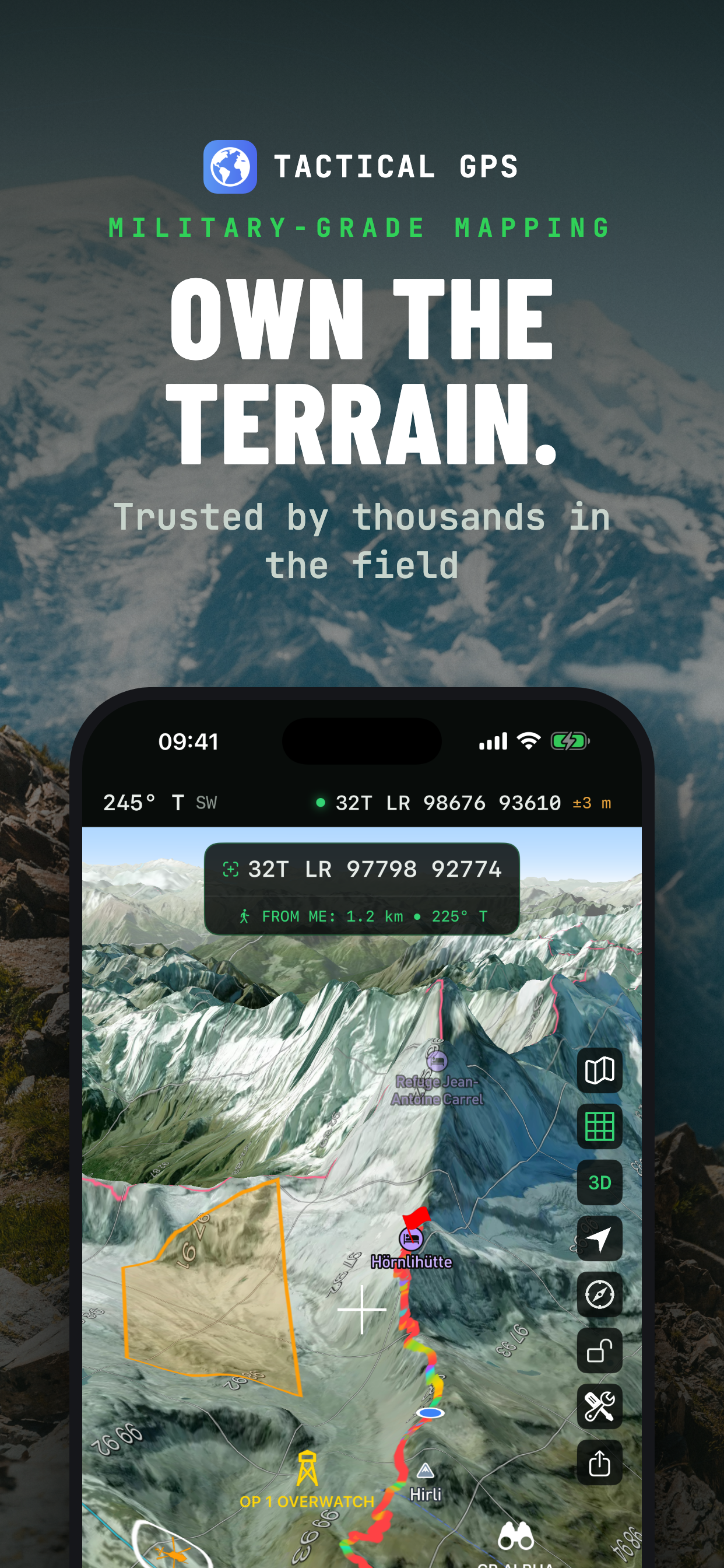
Tactical GPS is the Swiss Army knife of navigation - everything you need in one app. Plan routes, navigate cross-country, record tracks, analyze terrain and share your map with your team - online or fully offline, with the precision of a purpose-built instrument. Made for soldiers, SAR teams, hikers, hunters and anyone who reads maps. Designed and built natively for iPhone and iPad. No cross-platform compromises. Just a fast, precise tactical navigation experience.
SHARE & SYNC - NEW
• Share a map layer with your team over iCloud: everyone sees pins, routes and shapes update live - photos, voice memos and PDF attachments included. Invite-only, no accounts, no exporting.
• Connect to a TAK server to exchange position and data in real time, with built-in certificate enrollment
• Export your work as GPX, KML/KMZ, GeoJSON, CSV or DXF and continue in any other tool
PLAN, NAVIGATE, TRACK
• Plan routes and areas directly on the map, online or offline
• Generate routes with elevation profiles
• Navigate point-to-point or along a route - live distance, bearing, ETA, back azimuth and elevation delta
• Record tracks with pause, auto-pause and a Live Activity on your Lock Screen
• Set up geofences and location alerts
• Organize everything in layers - keep missions, trips and training areas separate
MAPS, ONLINE OR OFFLINE
• Download map regions for fully offline use
• Live topographic contour lines and hillshading
• MGRS, UTM or Lat/Lon grid overlay on every basemap
• Overlays for trails, cycling, ski slopes and sea marks
• Night-vision mode: red or green monochrome display across the entire app
FIELD & TERRAIN TOOLS
• Viewshed and line-of-sight analysis
• Range rings, bearings and point projections
• Distance and area measurement
• NATO (APP-6) map symbols
• Elevation and depth readings anywhere on the map
• On-position weather forecasts
PRECISION POSITIONING
• MGRS / UTM / USNG / Lat-Lon, plus national grids: British, Irish, Swedish, Finnish, New Zealand and more
• Dozens of map datums with proper transformations
• True, magnetic or grid north reference
• Connect an external Bluetooth GNSS receiver for higher-precision positioning
• Import GPX, KML/KMZ, GeoJSON, GeoPackage, Shapefile, CSV and more
PERFECT FOR
• Land navigation and route planning
• Hiking, cycling and off-road exploration
• SAR and field operations
• Outdoor training and navigation exercises
Note: Route navigation, additional maps, unlimited overlays and layers, special tools, tracking, iCloud layer sharing and export features require a PRO upgrade.
商店排名
商店排名基於Google和Apple設定的多個參數。
所有類別 在
美國--
導航 在
美國--


 Alpine Quest: Tactical GPS Pro VS.
 10月 14, 2026