

10月22日的Taider应用程序分析

Taider
- Navcart sp. z o.o.
- Apple 应用商店
- 免费
- 导航
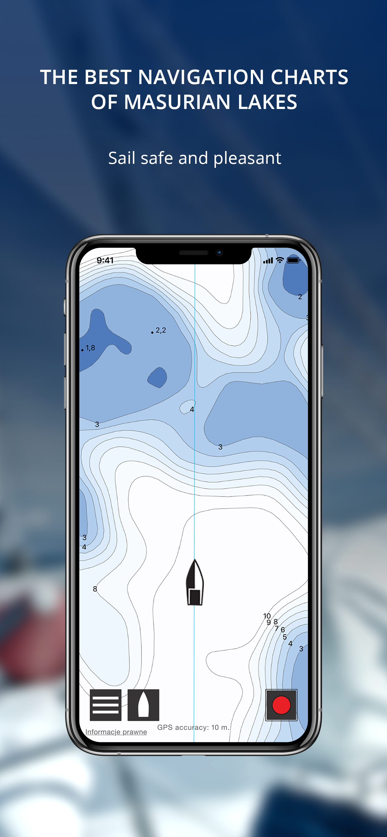
The best nautical charts of masurian lakes in your phone. Depth, shallows, underwater rocks, port layouts and prices, moorage spots, colision alert, route record. Test for free.
TAIDER is the best navigation application for Masurian sailors. The most accurate nautical charts on the market were created specifically to cover your needs. We have created innovative features to make sailing even more comfortable and safe. TAIDER is an irreplaceable application to find the right direction on the Masurian Lakes.
What you get?
+ The best navigation charts of Masurian Lakes - TAIDER contains the best bathymetric charts, made on the basis of newest bathymetric surveys. Our charts cover all of the Great Masurian Lakes* and are very clear and intuitive in usage. Having them makes you able to sail even during the night or in the fog. On TAIDER charts you will find all necessary information like depth, ports layouts, jetty locations, moorage spots, silence zones, reeds, forests and buildings.
+ Unmarked hazards - TAIDER’s charts contains even that shallow places and stone reefs which have not been marked with buoys on the water. When sailing on Masurian Lakes, you don’t have to be limited by lateral marks. Feel safe and free to sail across all the Great Masurian Lakes.
+ Collision alert - TAIDER has an innovative warning system. You don’t have to frequently check your position on the map. TAIDER will warn you about nearby hazards by emitting a sound signal, and give you the time to correct your course.
+ Marinas information - Wonder which port fits your needs? TAIDER provides all information about available infrastructure, including port plans, mooring methods and prices.
+ Mooring spots - Masurian Lakes show their true beauty away from loud and crowded ports. TAIDER will show you all the best places for mooring at the shore.
+ Cruise info - TAIDER allows you to display and record your trail. After returning from a cruise, you can recall memories by replaying the route you have traveled on eg. using Google Earth.
+ Tools useful in cruise planning and navigation: route planning and distance measurement.
*Bathymetric charts of lakes currently available in Taider app: Ryńskie, Tałty, Mikołajskie, Bełdany, Nidzkie, Roś, Tałtowisko, Jagodne, Boczne, Niegocin, Tajty, Kisajno, Dargin, Łabap, Dobskie, Mamry, Święcajty. More lakes soon.
商店排名
商店排名基于 Google 和 Apple 设置的多个参数。
所有品类在
美国--
导航在
美国--


 Taider VS.
十月 22, 2026