

10月9日的Swiss DroneMap应用程序分析

Swiss DroneMap
- Benjamin Koch
- Apple 应用商店
- 付费
- 导航
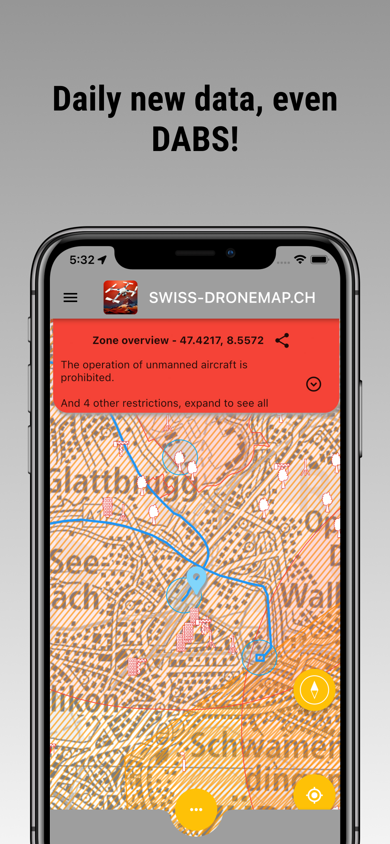
Swiss Drone Map is an interactive drone map for planning drone flights in Switzerland. Check drone zones, airspace restrictions, airports, protected areas, aviation obstacles, NOTAM and DABS information directly on the map.
The app helps recreational and professional drone pilots assess a planned flight location and collect important information before take-off. You can also store and manage personal documents required for private or commercial drone operations.
SWISS DRONE MAP
The drone map of Switzerland includes:
• national and cantonal drone airspace restrictions
• airports, heliports and control zones (CTR)
• hospital helipads
• military areas
• prisons and critical infrastructure
• nuclear power plants
• nature reserves and wildlife protection areas
• energy and gas infrastructure
• aviation obstacles such as buildings, masts and power lines
• nearby parking locations
• seven different base map styles
NOTAM, DABS AND LIVE AIR TRAFFIC
Swiss Drone Map provides access to current NOTAM and DABS information for today and tomorrow. Publicly available position data for aircraft and helicopters can also be displayed on the map.
Live traffic data is provided for information only. It may be incomplete or delayed and must not be used for navigation, separation, collision avoidance or other operational decisions.
EASY-FLY ZONES
The Easy-Fly view visualises distances of 30 and 150 metres from settlements, forests, railway lines and power lines. It provides a quick first assessment of a planned drone flight area but does not replace a legal review or an on-site risk assessment.
DOCUMENTS FOR DRONE PILOTS
Store important documents directly in the app:
• remote pilot certificate from UAS.gate or EASA
• UAS operator registration number for private or commercial use
• proof of insurance
• additional personal flight and operating documents
CHECK AIRSPACE AND NO-FLY ZONES
Before every drone flight, check whether restrictions, authorisation requirements or temporary no-fly zones apply at the planned location. The Swiss drone map helps you identify possible conflicts with aircraft, helicopters, protected areas and critical infrastructure.
Ignoring applicable drone regulations may result in fines or other legal consequences. Always verify the latest information provided by the responsible authorities and assess the actual conditions at the flight location.
UPDATES AND DATA SOURCES
Flight-related map data is updated regularly, usually every day. Links to NOTAM and DABS information are refreshed regularly.
The map is based on publicly available official and open data sources:
• Swiss Federal Geoportal / swisstopo – map.geo.admin.ch
• Swiss Federal Office of Civil Aviation, FOCA – bazl.admin.ch
• DABS and NOTAM information – skybriefing.com
• live air traffic data – OpenSky Network
External content opens directly on the website of the original provider. Government data is not presented as an independent official publication by this app.
DISCLAIMER
Swiss Drone Map is an independent application. It is not affiliated with, endorsed by or representative of any government authority or public organisation.
All information is provided solely to support drone flight planning. Information may be incomplete, delayed or inaccurate. The app does not issue flight authorisations and does not confirm that a drone flight is legally permitted at a specific location.
Before every flight, consult the responsible authorities for current regulations, permits and restrictions. Also consider local rules, temporary restrictions, property rights, privacy, nature protection and the actual situation at the flight location.
Fly responsibly and discover Switzerland from above.
商店排名
商店排名基于 Google 和 Apple 设置的多个参数。
所有品类在
美国--
导航在
美国--


 Swiss DroneMap VS.
 十月 9, 2026