

Sie haben Ihr Suchlimit erreicht
Starten Sie Ihren kostenlosen Testzugang, um weiterhin alle Traffic- und Performance-Insights zu erkunden.
Los geht'sLink-H App-Analysen für 19. November

Link-H
- Ibrahim gurdal
- Apple App Store
- Kostenlos
- Navigation
Link-H is a flight tracking and situational awareness app designed especially for VFR pilots, helicopter operators, flight groups, and aviation users who need a simple way to share and monitor live positions.
You can also use Link-H to track family members, business partners, fleet vehicles, or any group that wants private location sharing through a simple tracking channel.
Key Features:
• Real-time location sharing
Share and view live positions with periodic updates.
• Private tracking channels
Create or join a tracking group with a simple channel number. No admin setup is required.
• Location history
Review your own tracks and the movement history of people you follow.
• Flight information
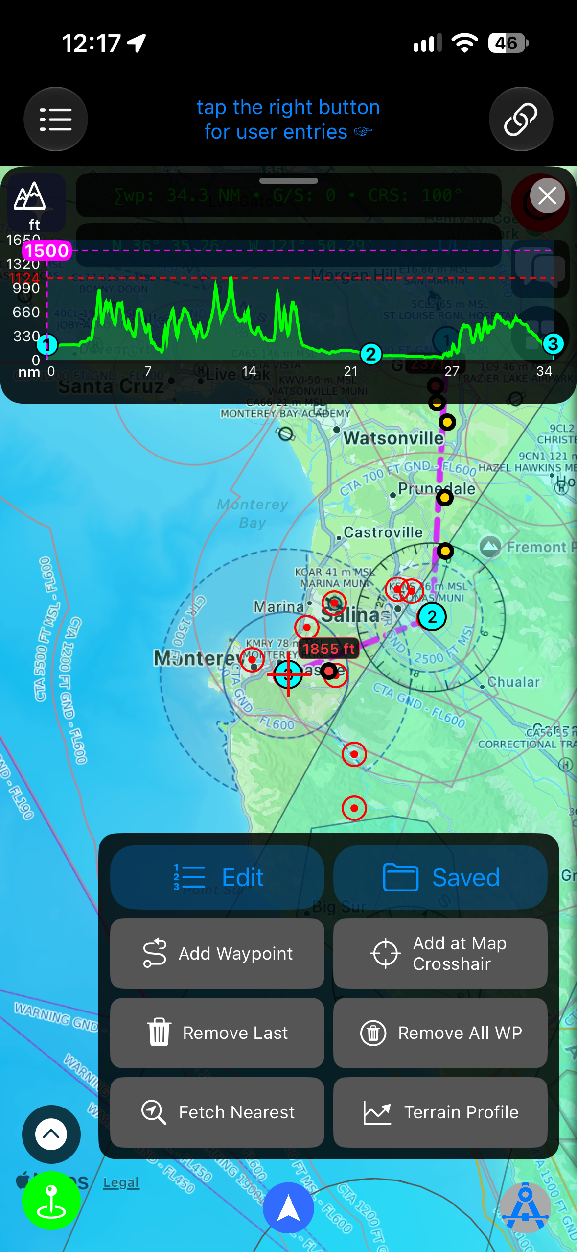
View useful tracker data such as update time, course, speed, altitude, bearing/range, distance to tap point, time to tap point, battery level, and address information.
• Aviation map layers
Use satellite, standard map, OSM, TOPO, terrain/elevation, NOTAM, and other aviation-focused overlays.
• Airport charts and PDF overlays
Import supported airport charts, view chart-based ownship position when geospatial data is available, and overlay compatible charts on the map.
• NOTAM awareness
Load and display NOTAM areas on the map, inspect details, and adjust overlay visibility.
• Weather information
Access METAR and TAF reports, meteorological radar, and satellite imagery.
• Widgets and notifications
Use widgets and alerts for visibility, cloud base, and other operational awareness items.
• Flight logs
Record and review flight history.
• Terrain and elevation data
Use elevation-based map features to improve situational awareness.
Link-H is intended to support situational awareness. It is not a certified navigation system and must not be used as the sole source for flight planning, navigation, or operational decision-making. Always use official aviation publications, approved charts, and certified equipment where required.
Terms of Use (EULA)
https://www.apple.com/legal/internet-services/itunes/dev/stdeula/
Privacy Policy
https://imgapps.net/privacypolicy
Rang speichern
Der Store-Rang basiert auf mehreren Parametern, die von Google und Apple festgelegt wurden.
Alle Kategorien in
Vereinigte Staaten--
Navigation in
Vereinigte Staaten--
Top-Wettbewerber und alternative Apps
Apps mit hoher Wahrscheinlichkeit, von denselben Benutzer:innen aus demselben Store verwendet zu werden.

Wilco Map Weather Navigation

notams.aero

AeroChart

Spectrum
 Link-H VS.
November 19, 2026