

You’ve hit your search limit
Start your free trial to keep exploring full traffic and performance insights.
Get StartedAnálisis de la app RealityMaps 3D tour planner para 23 de octubre

RealityMaps 3D tour planner
- 3D RealityMaps GmbH
- App Store de Apple
- Gratis
- Navegación
RealityMaps Hiking Bike MTB
Best 3D map for challenging outdoor experiences, 3D route planner & tracking
Are you ready for unique outdoor experiences and exciting new places? The RealityMaps app is your perfect companion for challenging adventures – with the most accurate 3D map of all apps.
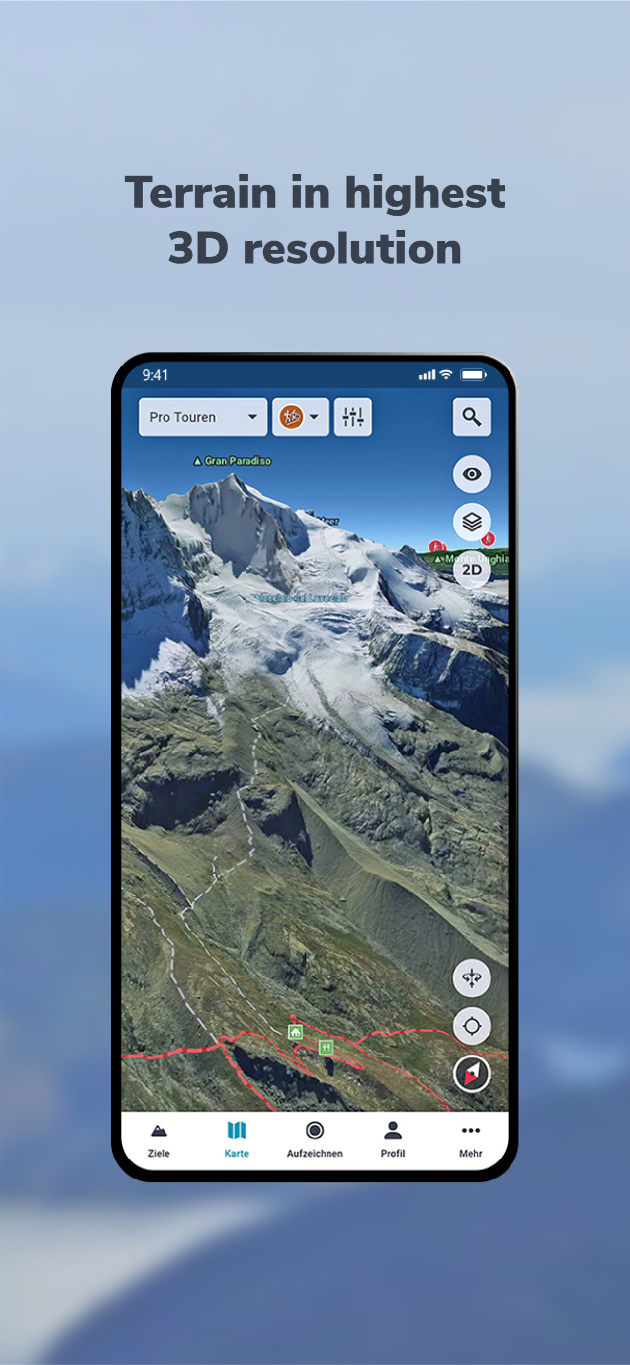
We create our realistic 3D map from aerial and satellite images using innovative technology. This allows you to accurately assess the terrain and plan your tour with confidence.
Be inspired by over 30,000 verified tours for hiking, biking, mountaineering, or skiing – in Europe's most beautiful mountain regions. Or plan your own routes directly in the 3D map, even off the beaten track.
Additional map information on hiking and biking trails, as well as slope gradient and orientation, will help you with your planning. The app also offers GPS tracking, GPX import, offline maps, and access to more than 5,000 webcams showing current conditions.
VERIFIED TOUR VARIETY
The app offers exclusively hiking, mountain, ski, and bike tours from Bergverlag Rother and other partners, thoroughly researched by experts. With the GPS, you can easily follow the marked routes of the tours.
DETAILED MAP MATERIAL
A topographical map in 2D and 3D complements the 3D map. Additional map layers provide information on hiking and cycling trails, as well as slope gradients and slope orientation.
GREATER SAFETY
The app offers the highest level of safety. The 3D map allows you to see the steepness and condition of the terrain and identify potential hazards. The resolution of the 3D map is so good that you can orient yourself even in bad weather, in fog, or at night.
GPS TRACKING
GPS tracking transforms your smartphone into a fully-fledged navigation device. While on tour, your current location is always displayed live on the 3D map.
PLANNING TOURS
With the routing function, you can plan your own routes directly on the 3D map or the topographic map. You can plan routes along existing paths or a route through pathless terrain to discover unique places.
RECORD AND SHARE YOUR TOURS
With GPS tracking, you can record tours and view the route you've taken live on the 3D map. Duration, distance, elevation, and speed are continuously recorded. Create your personal user account to save the recorded tracks, transfer your tracks to other smartphones or tablets, and share them with friends.
IMPORTING TOURS AS GPX
For unlimited tour variety, you can import tours in GPX format or from Komoot into the 3D map. This puts the entire world of hiking, biking, and mountain tours from the internet at your fingertips.
MAPS FOR SUMMER & WINTER
Global coverage with satellite images. High-resolution 3D map for the entire Alps and Pyrenees (summer & winter), as well as for other selected mountain regions in Europe (summer only).
OFFLINE MAPS
Important for your safety: download selected regions of the 3D map on your smartphone for use without an internet connection.
Try PRO features free for 7 days with no obligation.
Register and try all PRO features free for one week.
- Detailed tour descriptions
- Unlimited tour recording, saving, sharing, and transferring to other devices
- All map layers (2D and 3D, aerial photography and topographic maps, hiking and cycling trails, slope gradient and slope orientation)
- Save the 3D map to your smartphone for offline use
- Plan tours in 3D
- Automatically synchronize self-recorded, planned, and imported tours between the app and the web tour planner
EULA: https://www.apple.com/legal/internet-services/itunes/dev/stdeula/
Clasificación de tiendas
El Store Rank se basa en múltiples parámetros establecidos por Google y Apple.
Todas las categorías en
Estados Unidos--
Navegación en
Estados Unidos--
Principales competidores & aplicaciones alternativas
Aplicaciones con una alta probabilidad de ser utilizadas por los mismos usuarios, desde la misma tienda.

Relief Maps : backcountry gps

alpenvereinaktiv

Maps 3D Neo

Skida: Alpine Adventures
 RealityMaps 3D tour planner VS.
 octubre 23, 2026