

Thorsborne Trail 앱 분석 (10월 8일)

Thorsborne Trail
- jonathan ide
- Apple App Store
- 유료
- 내비게이션
This is the only app for hikers either walking or thinking of walking the iconic Thorsborne Trail on World Heritage listed Hinchinbrook Island in Far North Queensland, Australia. It is the perfect electronic guide and provides a rich set of features. The Island has very limited cellular access so the app aims to provide the hiker all of its comprehensive information without the need for a mobile connection.
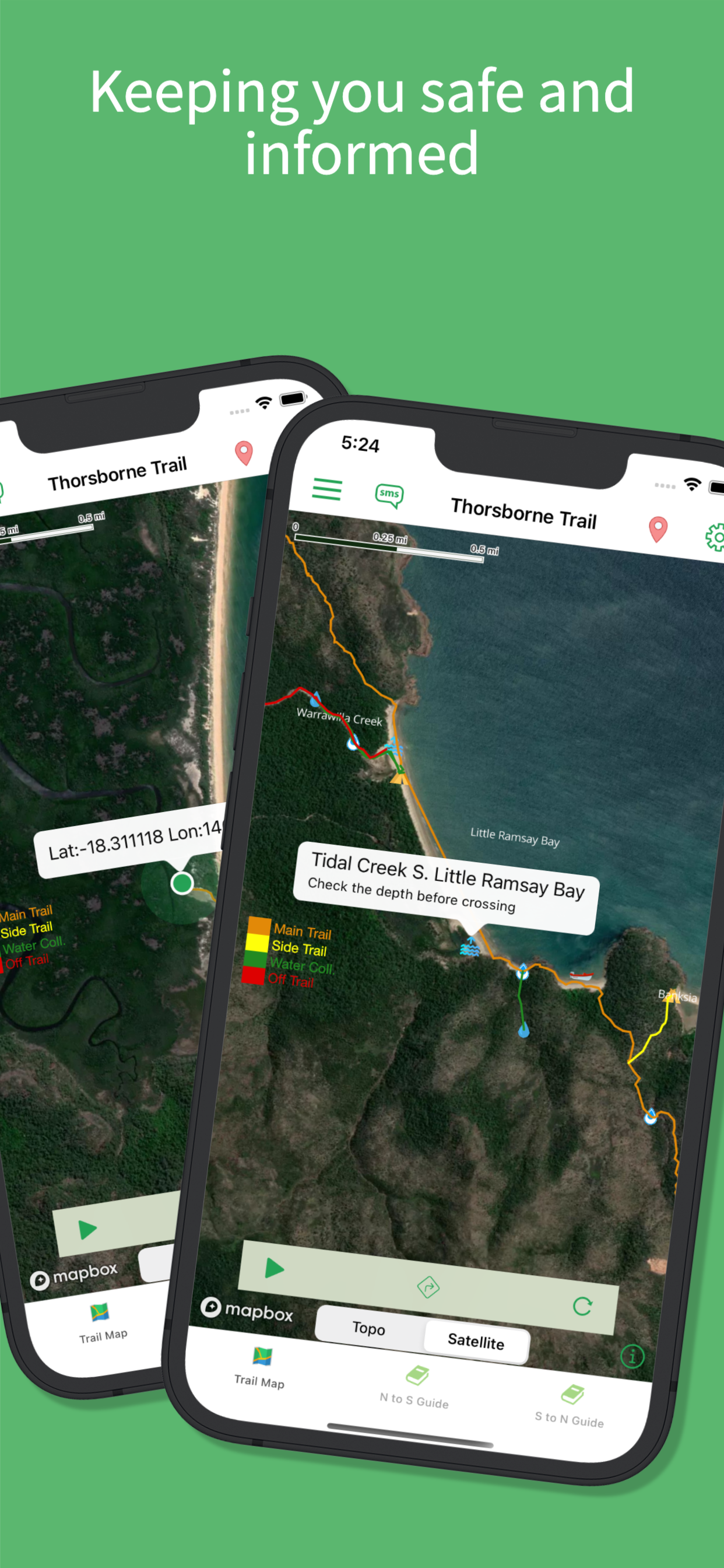
The app provides the hiker with both an on and off-line accessible topological Island map. This map can be zoomed and panned to show different perspectives of the trail and a satellite view is available when on-line. The map provides key trail-specific GPS generated features. These include the actual trail itself and useful metrics such as the distance walked so far, distance to the nearest water source and camp site. The app also provides a selectable set of icons that mark key locations on the trail for all season water sources, hiking season water sources, tidal creeks and locations for limited cellular access and also campsites. The hikers exact positional latitude and longitude is also provided by the map should that information be needed. The information provided by the app is a distillation of local knowledge some of which cannot be found anywhere else.
The app also provides the user with comprehensive trail notes in both directions of the walk. The hiker can switch between the map metric view and the route notes with a simple tab touch and both directions of the walk are covered by the guide in a simple clear format designed for reading.
The app emphasises safety on the trail - Hinchinbrook is a wild and unspoilt island with a few hazards which are identified by the app and should an emergency arise it will provide assistance in providing you not only your exact position but also locations on the trail where a call can be made. The app also provides off line BOM Lucinda tidal charts for the year. Knowing the tidal range for the days of your hike and where the tidal crossings are, including safe water levels which vary by creek, will ensure that you can plan a safe and unhindered walk. The app provides all this information to hikers.
For those wanting to see what a North to South Hike may look like from the comfort of your home there is a "Walk Simulation" feature in the settings menu - this shows an accelerated version of what the app will look like on the trail itself and will be a feature that is developed further in future releases to provide more information to the hiker for trip planning.
The app is perfect for those just thinking of doing the walk - the menu provides all the information you need to book the trail and the transfers required to get there along with a host of other useful information. There is even a gallery of our favourite spots on the Island and I'm sure when you see them you will understand why this walk deserves its own app - quite simply its one of the best in the world. Happy Hiking!
스토어 순위
스토어 순위는 Google과 Apple이 설정한 여러 매개변수를 기반으로 합니다.
모든 카테고리 ·
미국--
내비게이션 ·
미국--


 Thorsborne Trail VS.
 10월 8, 2026