

GPS & Map Toolbox 앱 분석 (10월 6일)

GPS & Map Toolbox
- Audama Software, Inc.
- Apple App Store
- 유료
- 내비게이션
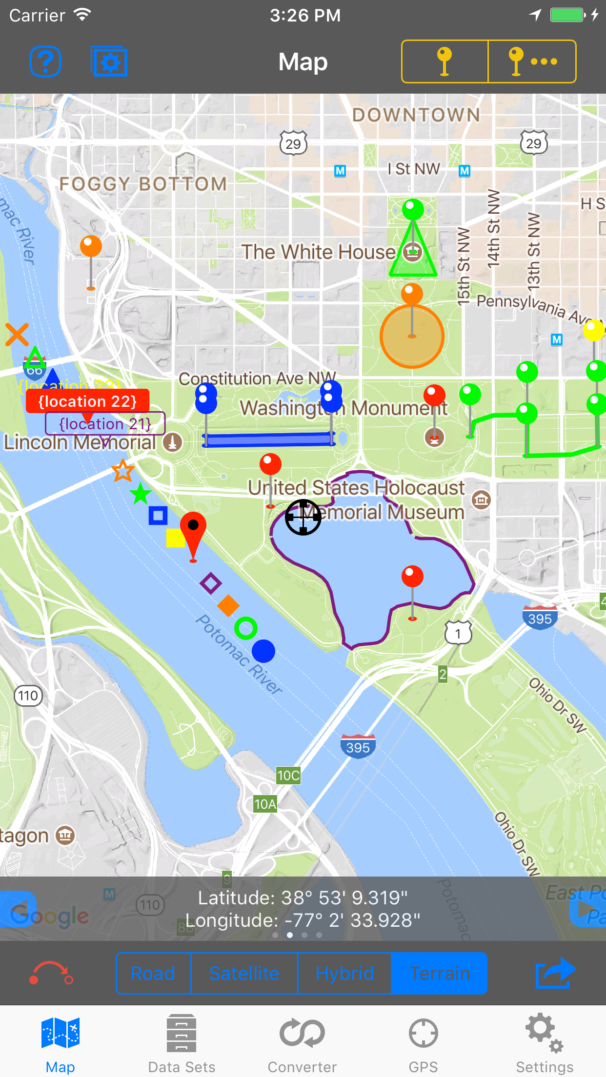
◦ This is the ultimate GPS location database tool designed to save, organize, share, display, import, export, and analyze location records and their properties.
◦ Extensive customization options make this app useful for everyone from salesmen, hikers, farmers, hunters, scientists, land/site surveyors, search & rescue, police, and military.
◦ The features are organized into levels so you only need to buy what you need. The basic features are available in the core app. The other feature levels can be added through an in-app purchase.
▼ BASIC Features (built into the core app) ▼
•Organize location data into Data Sets and basic Groups.
•View and convert between coordinate formats (Degrees Decimal, Degree/Minutes, and Degrees/Minutes/Seconds).
•Custom text and note properties.
•Display a single map overlay for each location.
•Raw GPS data.
•Share data with other devices running this app.
•Send locations to third-party apps for mapping and navigation.
•Extensive in-app help screens explain all features and options.
▼ PROFESSIONAL Features (available through an in-app purchase) ▼
•Group locations into Areas, Track/Paths, and Routes.
-Display groups on the map with customizable lines and fills.
-Perform calculations on groups.
•Additional coordinate formats: UTM (Standard and Extended), USNG, and MGRS.
•Display Secondary coordinate.
•Custom properties such as numbers (with and without units) along with automatic data detection.
•Export data sets to third-party apps.
•Additional map marker style options.
•Export file types: GPX, KML/KMZ, CSV (comma separated values), TXT (tab delimited values).
•Business Search.
•Full-screen map screenshots.
▼ ADVANCED Features (available through an in-app purchase) ▼
•Attach photos to data sets and locations.
•Additional coordinate formats: British National Grid, and Dutch National Grid.
•Location templates allow you to specify custom properties that are automatically created with every new location.
•import file types: GPX, KML/KMZ, CSV (comma separated values), TXT (tab delimited values).
•View location data from multiple data sets simultaneously.
•Multiple map overlays per location with additional types.
•Text based Routing (bearing and direction between points in route).
▼ Extra Data Sources (available through an in-app purchase) ▼
•Use non-Apple data sources (Google and OpenStreetMaps) for map data. This includes map view, elevation, geocoding, business/place search, and street view.
스토어 순위
스토어 순위는 Google과 Apple이 설정한 여러 매개변수를 기반으로 합니다.
모든 카테고리 ·
미국--
내비게이션 ·
미국#178


 GPS & Map Toolbox VS.
 10월 6, 2026