

You’ve hit your search limit
Start your free trial to keep exploring full traffic and performance insights.
Get StartedAnálisis de la app iGeoTrans X Lite para 21 de octubre

iGeoTrans X Lite
- TRAN TRUNG CHUYEN
- App Store de Apple
- Gratis
- Navegación
iGeoTrans X Lite is the free version of iGeoTrans X — a coordinate conversion, mapping, and field survey app for users working with coordinates, boundaries, and spatial data across different countries and regions.
The app is not limited to Vietnam. With more than 200 coordinate systems, it converts between local, national, projected, WGS-84, and GPS coordinates for domestic and international projects.
It is useful when bringing projected coordinates from documents, drawings, permits, area boundaries, routes, land-use boundaries, or technical datasets onto a map, then using GPS to check locations, navigate, stake out points, survey, compare boundaries, or support real estate asset appraisal.
The app also supports custom coordinate systems for project-specific, local, or regional requirements.
SUITABLE FOR
• Survey engineers and GIS specialists
• Construction contractors and infrastructure teams
• Mining, geological exploration, and mineral survey projects
• Environmental, forestry, and natural resource management work
• Land management, real estate, planning, and appraisal workflows
• Bank staff, asset appraisers, and collateral appraisal teams
• Boundary staking, site checking, and field operations
FREE FEATURES — NO TIME LIMIT
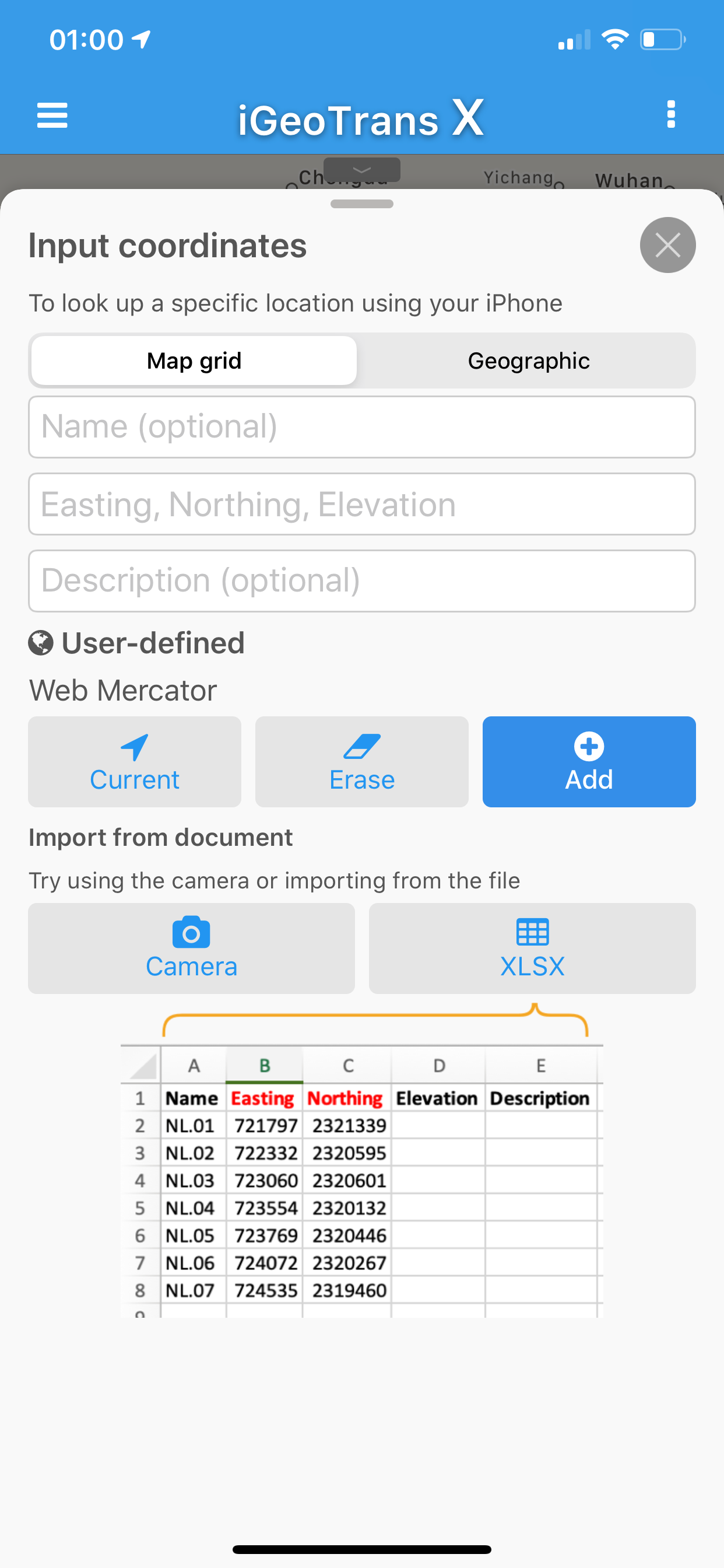
• Convert between more than 200 coordinate systems, including VN-2000, WGS-84, UTM, Gauss-Krüger, and many others
• Convert local or projected coordinates to WGS-84/GPS for map display
• Convert GPS/WGS-84 positions to local or project coordinate systems
• Define custom coordinate systems based on user or project requirements
• Full support for VN-2000 3° and 6° projection zones for all provinces and cities in Vietnam
• Display GPS coordinates in any supported coordinate system
• Bring projected coordinates onto the map to check locations in the field
• Create survey projects and add GPS points, lines, and polygons directly on the map
• Check licensed boundaries, project boundaries, land-use boundaries, survey areas, and working zones
• Load offline maps: MBTiles and OGC-compliant GeoPackage (.gpkg)
• Add vector overlays: KML, KMZ, and GeoJSON, GeoServer / WMS
• Combine GPS with overlays to compare real-world positions with imported data
• Overzoom tiles beyond the original maximum zoom level
• Import data from iCloud Drive and the Files app
• Export data to KML, GeoJSON, and CSV
• Record GPS tracks during field surveys
REAL-WORLD USE CASES
• Convert local, projected, or project coordinates to WGS-84/GPS for field checking
• Bring mining license boundaries into the field
• Check geological and mineral exploration areas
• Compare GPS positions with project boundaries, land boundaries, or survey zones
• Support environmental, forestry, and natural resource management work
• Stake out boundary points, routes, and polygons from coordinates
• Check construction sites, infrastructure routes, and working areas
• Support real estate checks for bank staff, asset appraisers, and collateral appraisal teams
• View planning overlays, thematic maps, or user-imported data
• Suitable for international projects requiring multiple coordinate systems
UPGRADE TO PRO
• Remove ads
• iCloud Sync — sync projects, objects, and tracks across devices
• Unlimited objects per project
The free version allows up to 2 objects per project
• Priority support
• Access to all future Pro features
PRO PLANS
• Monthly subscription
• Yearly subscription with a 7-day free trial
• One-time 3-month purchase with no auto-renewal
Payment will be charged to your Apple ID account when the purchase is confirmed. Auto-renewable subscriptions renew unless auto-renewal is turned off at least 24 hours before the end of the current period.
Privacy Policy:
https://igeotrans.rbc.vn/en/privacy.html
Terms of Use:
https://igeotrans.rbc.vn/en/terms.html
Terms of Use (EULA):
https://www.apple.com/legal/internet-services/itunes/dev/stdeula/
Clasificación de tiendas
El Store Rank se basa en múltiples parámetros establecidos por Google y Apple.
Todas las categorías en
Estados Unidos--
Navegación en
Estados Unidos--
Principales competidores & aplicaciones alternativas
Aplicaciones con una alta probabilidad de ser utilizadas por los mismos usuarios, desde la misma tienda.

Survey360

MyGIS

Mit Map: DGN, DWG, DXF, VN2000

Thongtin.land-
 iGeoTrans X Lite VS.
octubre 21, 2026